Capitol Ravine Excavation
Evidence of Williamsburg's Changing Landscape
Much of our recent archaeological research has focused on Williamsburg's 18th-century landscape. Natural ravines are characteristic of the local terrain, yet we know that centuries of filling, terracing, smoothing, banking, carving, and countless other earthmoving activities have altered the town's appearance. So how different were the 18th-century town's topography and plant life? Exploration of the ravine near the Capitol has proven an important step towards answering this question.
The First Excavation
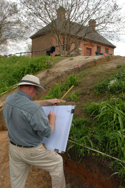
The Capitol ravine lies at the east end of Duke of Gloucester Street. Today it is recognizable as a steep cut between the Coffeehouse and the Secretary's Office. But did it look the same to Coffeehouse patrons in the 1760s? In 2010, archaeologists set out to answer this question by excavating a narrow "slice" through the ravine embankment on the Coffeehouse side.
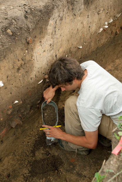
The accumulation of soil layers, both man-made and natural, was dramatically visible in the slice. Artifacts recovered from each layer helped to establish the dates of major changes to the ravine's topography. Moreover, a series of environmental samples (pollen and phytoliths) documented the various forms of plant life that have grown on the site.
Evidence of the Coffeehouse
The 2010 excavation told half of the story of a much altered landscape. Williamsburg's early 18th-century residents knew this as a wider and shallower ravine than we know today. Then, beginning in 1720 with the filling and leveling of Duke of Gloucester Street, and continuing with construction of the Coffeehouse in 1750, a series of ravine-altering changes were set in motion.
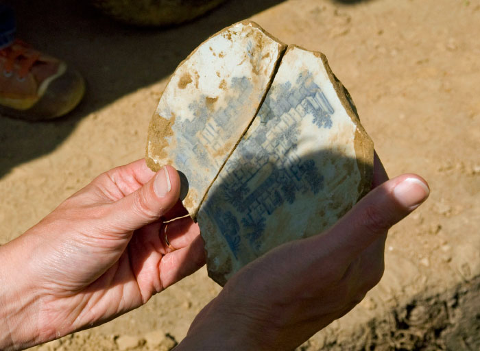
Rain that once drained gently off the street found its course blocked by the Coffeehouse. Cascading around the building, the water scoured deep channels in the ravine. These channels soon filled with debris from Richard Charlton's successful business just upslope: wine bottles, tumblers, wine glasses, plates and tea wares, chamber pots, food remains, and nails.
The greatest changes to the ravine's west side, however, were a product of erosion and deposition during the 19th and 20th centuries. Nineteenth-century demolition of the Coffeehouse, plus subsequent construction of a residence (1891) and a cistern, created ground disturbances that covered 18th-century ravine layers with three feet of fill.
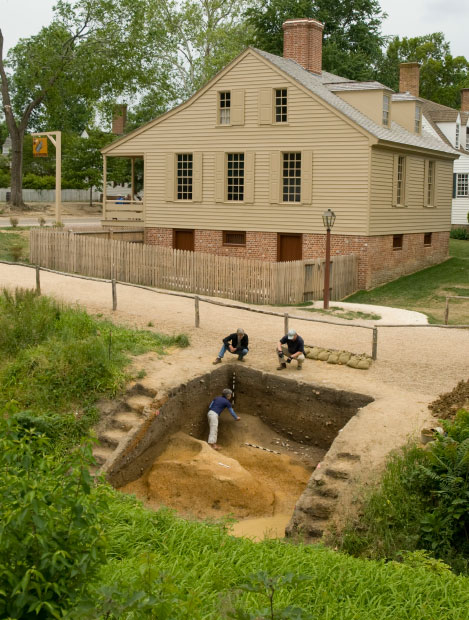
2014: Return to the Ravine
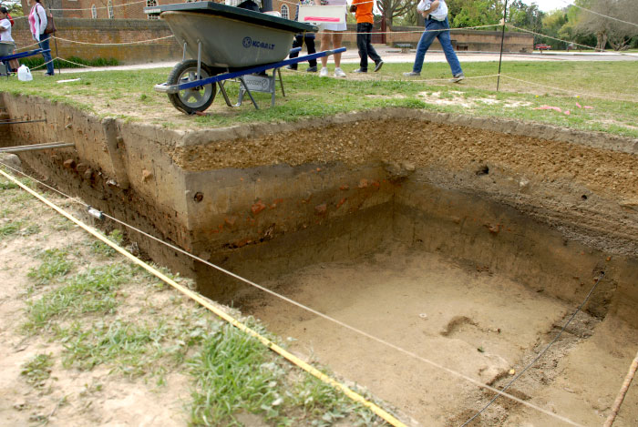
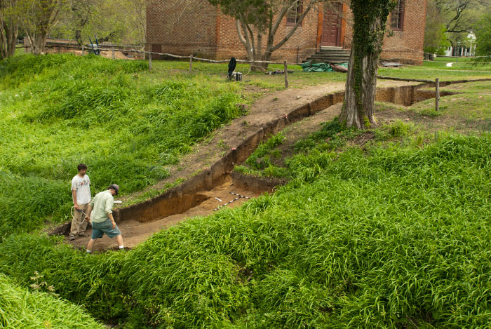
Landscape studies, including the Capitol ravine project, are massive in scale, requiring multiple projects to produce a full picture. In 2014, thanks to generous donors, archaeologists were able to return to the Capitol ravine to dig a mirror "slice" through the opposite, east bank.
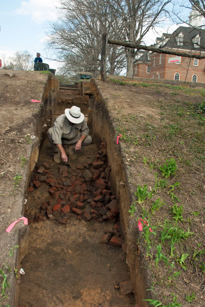
Archaeologists began this dig with a few assumptions. The type of work conducted in the Capitol and Secretary's Office were unlikely to have generated significant trash, so we anticipated finding fewer artifacts than on the Coffeehouse side. On the other hand, two catastrophic fires at the Capitol—one in 1747 and another in 1832—would certainly have produced a great deal of brick rubble. Rubble would likely have been discarded in the ravine.
(Charlie Wilson, 2014)
A Tale of Two Fires
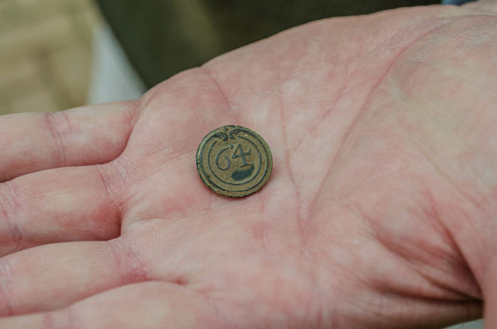
Six weeks of work at the ravine did, indeed, reveal evidence of two Capitol fires. Brick rubble from the 1747 fire was found on the terrace above the ravine, where it was used to level the land in preparation for building the Secretary's Office in 1748. An additional spread of brick, scattered down the ravine face, proved challenging to date, due to the predicted scarcity of artifacts. However, a military uniform button discovered beneath the rubble provided a vital clue. This button came from the 64th Regiment French artillery, which was in America only a short time—from 1780 until 1783. As this datable button came from under the rubble, the rubble itself had to be from the later Capitol fire in 1832.
The history of the ravine's east side appears to be somewhat different from the west. While the Coffeehouse side has filled in over time, the slope at the Secretary's Office was deliberately (but for unknown reasons) cut away sometime in the 18th century. Equally mysterious is a deposit of dense clay, 20 feet wide and 6-7 feet deep, found at the bottom of the slope and adjacent to the present creek bed. Spread out after the Revolution but before the 1832 Capitol fire, the function or cause of this clay spill remains unknown.
Applying What We Have Learned
While topographic and environmental studies add to our understanding of 18th-century Williamsburg, physically recreating those features is not always practical or even desirable. Contouring the Capitol ravine to match its 18th-century appearance would cause countless problems on adjacent lots. And Colonial Williamsburg's visitors would find the sparse 18th-century tree cover to be hot, bright, and extremely uncomfortable.
So what to do with collected data? The information gathered in this and other landscape studies finds a home in a 3D computer model: Virtual Williamsburg. In a digital environment, 18th-century ravines, unshaded streets, and weed-choked corners are easily brought back to life.
Archaeobotanical evidence, in the form of recovered seeds, pollen, and phytoliths, also plays an important role in Colonial Williamsburg's ongoing environmental research. As sources of information on everything from animal husbandry and household provisioning to climate change, these data are guiding archaeologists into new areas of exploration.