Printing Office and Post Office (LL) Archaeological Report,
Block 18-2 Building 12B Lot 48Originally entitled: "The Virginia Gazette Site
Excavations of 1938-Volume I Colonial Lot #48 Block 18 - Archaeological Area H"
Colonial Williamsburg Foundation Library Research Report
Series - 1416
Colonial Williamsburg Foundation Library
Williamsburg, Virginia
1990
THE VIRGINIA GAZETTE SITE
Colonial Lot 48
Block 18 Archaeological Area HARCHAEOLOGICAL RECORD
Volume I
Excavations of 1938
Volume II - Excavations of 1951-52
Volume III - Archaeological Laboratory Report
VOLUME I Archaeological Report VIRGINIA GAZETTE SITE
| Preface to Volume I. |
| List of photographs. |
| Archaeological Report by Francis Duke, dated Aug. 15, 1939. |
| General Report by S. P. Moorehead, dated March 1938. |
| Archaeological Survey of Foundations Uncovered, dated April 21, 1938. |
| Sketch showing Proposed Virginia Gazette Building, dated March 1938 (revised Dec. 1951). |
Assembled and Edited October 15, 1954 by 0. M. Bullock, Jr.
PREFACE TO VOLUME I
This report covers the findings revealed by archaeological excavations of Colonial Lot 48, in Block 18 known as archaeological Area H, which were made in 1938 by Mr. J. M. Knight of Colonial Williamsburg.
The report includes a General Report, which analyzes the findings, written by S. P. Moorehead in 1938 while the excavation was in progress, and a detailed report written by F. J. Duke in 1939, which records in detail the foundations, etc., which were revealed.
The property is owned by Mrs. Virginia B. Haughwout who authorized the excavations by an agreement made in 1938 (see Colonial Williamsburg "Legal" Files) which indicates that "…the Restoration be allowed to retain such relics or excavated materials as it may desire to keep."
The area excavated is indicated in red on the following diagram, drawn in 1952, which also shows the foundations uncovered in subsequent excavations and a transcript of that portion of the "Frenchman's Map" which shows this part of Williamsburg.
The photographs used to illustrate the report are listed herein and the approximate point from which they were taken is indicated on the Archaeological Survey of Foundations Uncovered, designated p. __ herein.
In editing and assembling this report, no alterations or changes in "fact" have been made from the original reports.
O. M. B., Jr.
 From Frenchman's Map
| Negative NumberDescription | Page |
| L-317Virginia Gazette Printing Office, 1881 | 6 |
| N-4422Virginia Gazette Site from West, 1933 | 8 |
| DNB64Virginia Gazette Site looking South in 1928 | 9 |
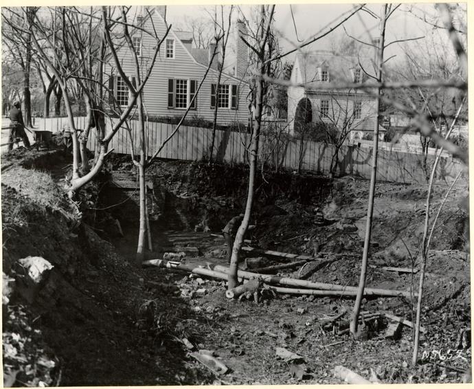
| N-5649Main foundation looking Southwest | 11 |
| N-5652Main foundation looking West | 12 |
| N-5653Main foundation looking Southwest | 14 |
| N-5656Chimney looking Southwest | 15 |
| N-5657South wall looking down | 17 |
| N-5662Fireplace looking Northwest | 19 |
| N-5661South retaining wall looking West | 23 |
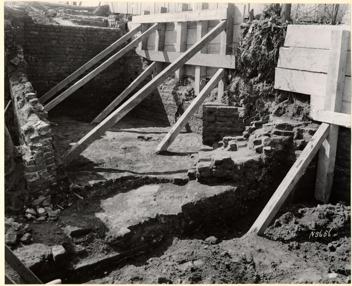
| N-5666Brick steps looking South | 25 |
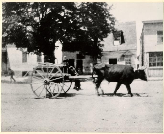 BUILDING A, 19TH CENTURY L. 317
ARCHAEOLOGICAL REPORT
Area H, Block 18 (Virginia
Gazette Printing Office)
August 15, 1939
Nature of the Site
Colonial Lot #48 originally sloped into a ravine, the bottom of which entered
the south end of the lot near the east corner, and thence ran generally
northward. Duke of Gloucester Street, crossing the ravine at right angles, was
raised c1720 on an earth fill high enough to carry it across almost on a level.
A large vaulted brick drain was provided under the fill. Perhaps at this time,
perhaps later1, a brick retaining wall was built along the north side of the
fill, where the ravine was deepest (i.e. across the eastern portion of the south
end of lot #48). This retaining wall occupied the entire distance between the
Printing Office2 and the next building eastward.3
In subsequent years the drain was rebuilt and extended northward. Material
was dumped over the retaining wall until a slope had been built up about half
way to the street level, concealing the northern face of the wall and the older
portion of the drain.
Excavation
The modern store on this lot, destroyed by fire c1922, was never replaced. In 1938 the foundations and paving of the original Printing Office were uncovered. Earth was removed down to hardpan, east of the office to a line beyond the drain, and north of the office proper for a distance of about 12 feet.
Eastward of the office foundations, no evidence was found of any structure prior to the modern store.
To northward, investigation was not carried as far as a small foundation
which, according to the
8
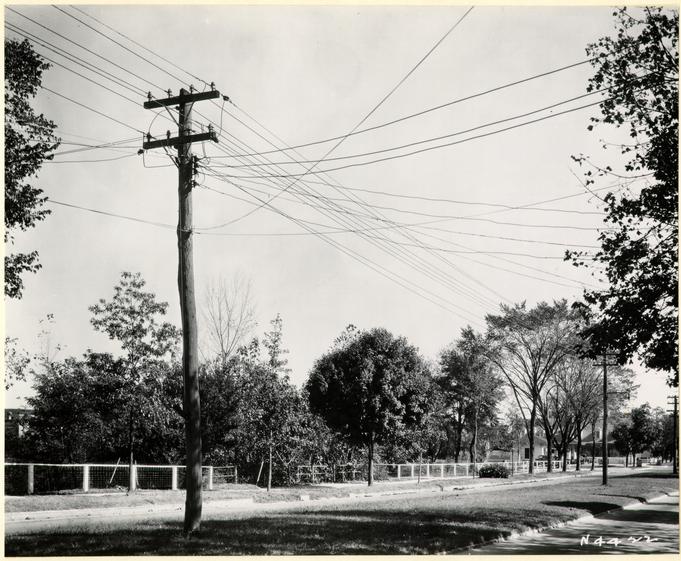 VIRGINIA GAZETTE SITE FROM WEST, 1933, N 4422
9
VIRGINIA GAZETTE SITE FROM WEST, 1933, N 4422
9
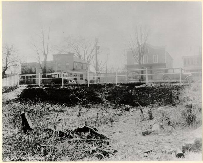 BUILDINGS A & B, DEC. 1928, DNB 64
10
Frenchman's Map, existed farther back in the lot. Since a deep fill covers
this area, excavation for the supposed foundation of a minor building would have
involved disproportionate expense.
BUILDINGS A & B, DEC. 1928, DNB 64
10
Frenchman's Map, existed farther back in the lot. Since a deep fill covers
this area, excavation for the supposed foundation of a minor building would have
involved disproportionate expense.
Material Uncovered: General
Excavation disclosed the inner sides and (except in one instance1) the tops of the retaining wall already mentioned, the south and west walls of the office proper, and a second retaining wall (much lower than the first) which continued northward along the western property line. Difficulty was encountered uncovering the outer sides of these walls, which in certain cases were badly disintegrated. A trench was however dug outside the south foundation wall for most of its length. Near the southeastern corner this trench was carried down to the bottom of the wall.
The western slope of the ravine originally extended into, perhaps across, Colonial Lot #47. The office stands at a point well down the slope. Its foundations extend a full storey's depth below present street level.
The street was raised to its present level2 within a year or two of the time3
when the office was constructed. It is not certain whether or not the grading
work had begun before the completion of the building.4 If not begun, it was
almost certainly under consideration.5 Thus, although the present basement
probably stood almost or quite clear of the ground at the time of construction,
it must have been intended
11
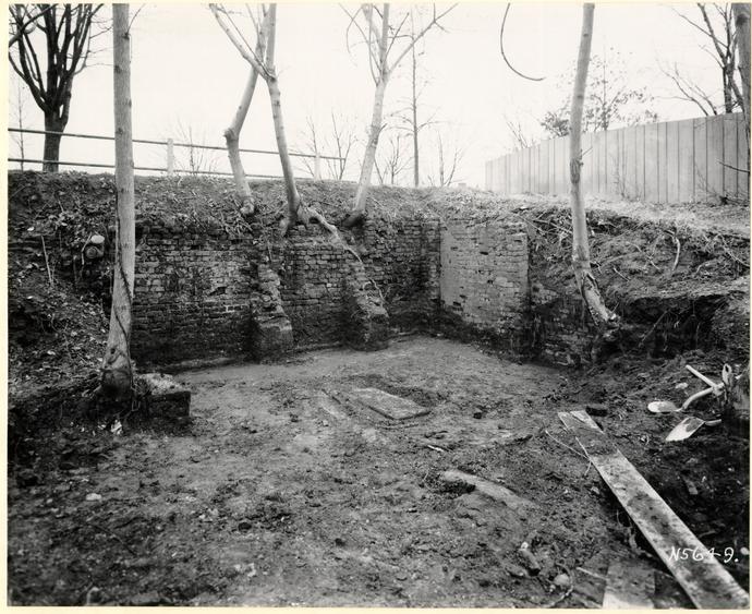 BUILDING A, FEB. 1938, PHOTO. N 5649
12
BUILDING A, FEB. 1938, PHOTO. N 5649
12
 BUILDING A, FEB. 1938, PHOTO. N 5652
13
from the first for a basement.1 The brickwork, wherever it has been preserved
(except for 4 courses of the east wall), is of the English bond which is
characteristic of basement construction. No water-table was found, nor were any
traces of inside plaster.
BUILDING A, FEB. 1938, PHOTO. N 5652
13
from the first for a basement.1 The brickwork, wherever it has been preserved
(except for 4 courses of the east wall), is of the English bond which is
characteristic of basement construction. No water-table was found, nor were any
traces of inside plaster.
On the east and north, however, where the ground lay lower, the walls were doubtless intended to stand clear of the ground, and doubtless contained windows and a door. (See detailed descriptions to follow.)
Detailed Descriptions
Floor
There are two levels of paving brick, the second of which is at an average level 14 or 15 inches higher than the first. The remains of the fallen south wall2 lie on top of the earlier pavement, leveled out to form the greater part of the fill on which the second pavement was laid.3 Both pavements are very fragmentary, apparently as a result of both wear and salvage operations.
After the south wall had collapsed,2 the decision to re-lay the pavement at a higher level was perhaps dictated by drainage problems, which may easily have developed in this location. A course of brick was found just inside the south wall, 9" wide, covered by a line of planks running lengthwise,4 and set 2c lower than the first pavement. This brickwork may have served as the floor of a drain: its general slope is to the east, or into the ravine.
14
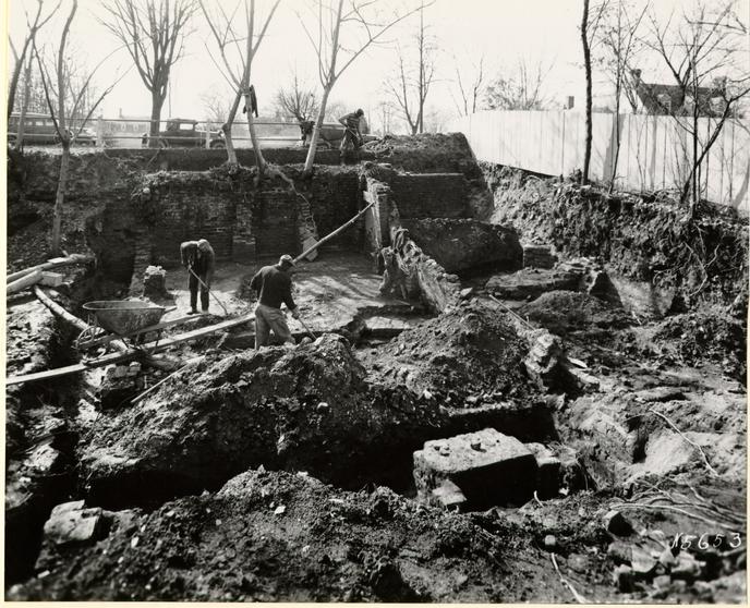 BUILDING A, FEB 1938, PHOTO N 5653
 BUILDING A, MAR. 1938, PHOTO. N 5656
Certain patches of brickwork 1c deep, near the same level, inside the north and east walls, may have formed part of the same drainage system.
Foundation under Floor
A rectangular mass of brickwork found in the east central part of the foundation begins about 8c below the second paving level, and is 6c high, but seems originally to have stood higher. This foundation is about 1½ by 3½ feet in size, and runs north and south. It may have served as foundation for a printing press at this level, or for posts under a press at the street-floor level.
| Brick | 9¼ x 4½ x 2¾. |
|---|---|
| Mortar | Shell. |
First South Wall
The first wall built on this site was 14" thick. Its bottom was stepped up from east to west, conforming more or less closely with the slope of the original grade. This wall fell over inward, no doubt giving away under the pressure of the street fill.
Broken bricks from the fallen wall remain to form part of a fill over the lower pavement. Of the wall itself, for most of its length, nothing remains standing except its lowermost courses (up to the level of the lower pavement). This dwarf wall leans inward, with an inclination in places as great as 1 in 12.
Near the west end this wall rises about 4½ feet higher.
| Brick | 8¾ x 4¼ x 2½. |
|---|---|
| Mortar | Shell. |
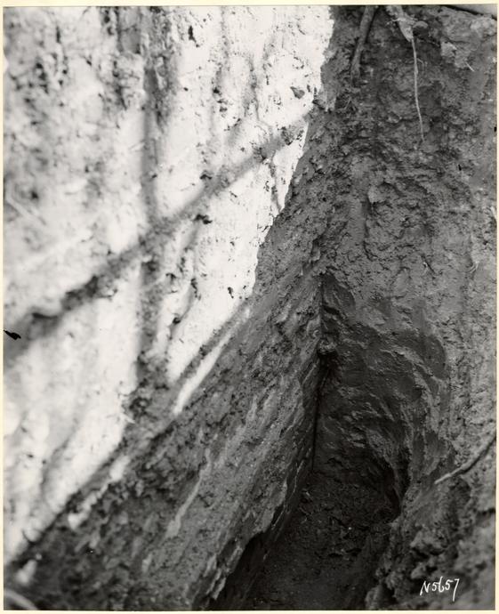 BUILDING A, MAR. 1938, PHOTO. N 5657
Condition
Some displacement due to the collapse of upper part and to subsequent soil
pressure
Second South Wall
On the foundation provided by the remnants of the first wall stands a second one, also 14" thick. The lower portion of this wall (to a height of some 18" above the lower paving level) is stepped out 1" to 2", perhaps as a measure to gain added strength.
Three buttresses, bonded in with the wall, rise from the upper layer of paving The central one projects about 2 feet, the others slightly more than 1 foot.
Near its west end, where the original wall rises higher, the second wall begins about midway of the total height. Here the lower (earlier) half has a 4" facing of brickwork of the second period, probably to strengthen it. (See Sect. A-A, Archaeological Survey Drawing.)
| Brick | 7-5/8 x 3¾ x 2½. English bond. |
|---|---|
| Mortar | Shell. |
Condition
Brick little damaged, mortar deteriorated, surface slightly out of plumb from
soil pressure, buttresses broken down except at base.
West Wall
Of early period, like original south wall in thickness, bond, mortar, and brick size. This wall apparently never contained any opening.
Condition
Fair except for a few missing bricks.
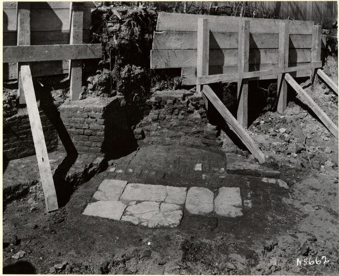 BUILDING A, MAR. 1938, PHOTO. N 5662
Chimney
The lining is built inside northwest corner of wall and is not bonded. Diagonal fireplace with back corners rounded. Stone hearth and brick underfire at lower paving level. At upper paving level a brick hearth and underfire seem to have been first provided, the level inside the fireplace having later been raised 3c, and the back wall built out to reduce the area of the underfire.
| Brick | 8¾ x 4¼ x 3. |
|---|---|
| Mortar | Shell. |
Condition
Fragmentary.
North Wall
The only existing brickwork is a short length at each end of the wall. This is of English bond, but bond may have changed to Flemish at a higher level, in conformity with east wall. In the gap between the ends the course of the wall is clearly traceable along a fill which contains bats and shell mortar.
| Brick | 8¾ x 4¼ x 2½, English bond. |
|---|---|
| Mortar | Shell. |
Condition
Unfit for re-use.
East Wall
Thickness and construction generally the same as for the other original walls Its bottom, like that of the south wall, is stepped down toward the southeast corner. Only at the 21 south and does the present brickwork rise above the level of the lower paving. Between 4 and 16 inches below this level is a band of Flemish bond, 4c high, with English bond below and above. No explanation can be offered for the reversion to English bond above the Flemish. But common practice would in any event hardly determine this bond, since the wall is that of a basement, but out of the ground.
One or two1 windows probably existed in this wall, but no traces remain because the brickwork ends well below the probable sill line.
| Brick | 8¾ x 4¼ x 2½. |
|---|---|
| Mortar | Shell. |
Condition
Fragmentary.
Stoop
In front of the south wall at its western end is a fragmentary foundation of later brickwork near street level, perhaps belonging to an entrance stoop. It seems likely2 that a door existed at this corner in the original building, or that, if a door was cut later, more than one step would be necessary to reach it.
| Brick | Salvaged. |
|---|---|
| Mortar | Lime. |
Rear Addition
Twelve feet north of the main foundation, remnants of piers indicate that a lean-to 22 existed on the rear at the street-floor level, probably with an open space below. That the pier construction is later than that of the main walls is indicated by the existence between the piers and the main foundation of a 4" layer of sand, such as builds up under the eaves of a house from the action of rain.
The easternmost pier turns the corner, and probably had an L shape. A fill between this pier and the northeast corner of the main foundation probably represents a low retaining wall which held the grade under the lean-to at a higher level than outside.
This foundation and the next one west probably stood about as high as the second pavement, and acted as footings for smaller piers. The third foundation is better preserved, and the beginning of a smaller pier can be seen on top of it. (Archaeological Survey Drawing, Sect. A-A).
The eastward opening between piers is considerably wider than the two westward. There is no direct evidence as to a reason for this, although the opening nearest the middle may have been determined in relation to a window or door opposite it, itself set as near as possible to the chimney; and the other two openings may have been allowed to come as they would.
| Brick | 8¼' x 3-7/8 x 2¾. |
|---|---|
| Mortar | Shell. |
Retaining Wall at Rear
From the northwest corner of the main foundation a 17" brick retaining wall extends northward along the property line. This wall rises only about 2 feet above the second pavement. Its original height, if greater, cannot be determined. It does not bond with the house wall but is built up to it, an indication of later date--as is its appearance.1 Masonry extends about 13 feet north of the house wall, and a fill was traced about 4' further.
23 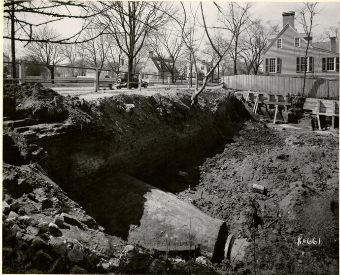 BUILDING C, MAR. 1938, PHOTO. N 5661
| Brick | 8½ x 4¼ x 2¾. English bond, joints pointed and lined. |
|---|---|
| Mortar | Shell. |
Condition
Unfit for re-use without radical reconstruction.
Stone Pier
Hard against the back or west side of the above retaining wall, and on a line with the lean-to piers1, was uncovered a rough stone foundation which (aided by the top of the retaining wall) probably supported a pier under the northwest corner of the lean-to.
Retaining Wall on South
Another colonial building2 stood 40 feet east of the Printing Office. The fronts of the two buildings lined approximately, and between their nearer front corners runs a brick retaining wall 34" thick. It is possible or even probable that this wall was built by the city at the time the street level was raised. The bottom of the ravine is about 12 feet below street level. The wall now rises3 towards the east to within about a foot of street level, and at the end butts against the west wall of the house, just back of the southern face. Towards the west the retaining wall drops away considerably, and ends against the southeastern corner of the Printing Office, which it overlaps by 4". Not being bonded with the Masonry of the office, the retaining wall must be of a later date, since the overlap of the wall could hardly have been provided for in advance of the building of the office. But the difference in time may be slight.
25 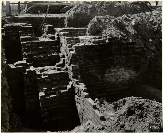 BUILDING C, MAR. 1938, PHOTO. N 5666
| Brick | 8¾ x 4¼ x 2¾. |
|---|---|
| Mortar | Shell. |
Condition
Unfit for re-use.
Brick Steps
At the eastern end of the retaining wall are remains of brick steps in very ruinous condition. A relieving wall 18" thick and parallel to the main wall at a distance of 2½ feet south, is here sunk below grade to a depth of more than 5 feet. Steps were built from this wall to end at the north edge of the main wall, out of the mass of which they were cut at the lower end. Cheek walls continued down to grade, 5 feet lower still. Probably they enclosed wooden steps, as there is no evidence that the brick ones continued north of the wall.
| Brick | 8¼ x 4 x 2¼. |
|---|---|
| Mortar | Shell. |
Condition
Bad.
Street and Attic Floor Levels In the Coleman Collection there is a photograph of the Printing Office taken c1889-90. A frame storey-and-a-half building is shown, with five openings on the street floor and two dormers.1
The arrangement of the openings suggests that a partition2 divided the body of the house into two unequal3 rooms of which the larger must have occupied the fireplace end. This partition was no doubt carried up through the attic floor.
| 1719-21 | … Michael Archer builds house on Colonial Lot #48. |
| 1720-22 | … £150 spent for raising street grade. |
| 1729 | … Joanna, widow of M. Archer, was living on this lot. |
| 1730 | … William Parks brings printing equipment from England, and establishes printing office in Williamsburg. |
| 1731 | … Parks doing business "near the Capitol in Williamsburg." |
| 1736 | … Parks begins publication of Virginia Gazette. His activities up to this time were presumably not carried on on Lot #48 because |
| 1737 | … A reference to William Hooper's, "formerly Mrs. Archer's" store, probably refers to the house on Lot #48, which is known to have belonged to Joanna Archer in 1729. |
| 1746 | … Direct reference to Printing Office next to lot 47, which must mean lot 48. Parks Therefore entered into possession of this property at an unknown time between 1737 and 1746. He carried on a large printing business. |
| 1750 | … Parks died. The estate lost the property for debts. The printing business was continued by |
| 1751-62 | … William Hunter: |
| 1762-66 | … Joseph Royle and Hunter's executors: |
| 1766-74. or later | … Purdie and Dixon. |
| 1780-1840 | … Lean-to added at rear during this period. |
| 1896 | … Gazette Office destroyed by fire. |
BASIS FOR REPORT
- 1.Fragments
All earth removed from within and near walls was screened, and earth in one location (where type was found1) was screened three times.
Between the two levels of basement paving numerous fragments of china came to light and were of use in dating the upper pavement.2 Other noteworthy finds included a brass drawer escutcheon and a number of diamond window-panes and lead cames.2
A large quantity of lead type was found just outside the foundation, at the east end about three feet south of center. The type is of several sizes and of 18th century character. Two binders tools and a pair of brass calipers in good condition were also found.
Artifacts are stored in the Archaeological Laboratory marked 18-H.
- 2.Photographs
Bound herein.
- 3.Archaeological Field Notes
See. Archaeological Notes file.
- 4.Archaeological Survey Drawing
A print is incorporated herewith.
- 5.Research Report
See Research and Records file.
- 29
- 6.John S. Charles: Recollections of Williamsburg, Virginia … Williamsburg, 1928, in separate file.
- 7.S. P. Moorehead: General Report on the Excavated Foundation of the Virginia Gazette Building. Colonial Lot #48, Block 18.
A copy is attached.
F. D.
Archaeological survey
Digital version unavailable
Footnotes
GENERAL REPORT
EXCAVATED FOUNDATIONS
of the
VIRGINIA GAZETTE BUILDINGColonial Lot 48, Block 18
GENERAL REPORT ON THE EXCAVATED FOUNDATIONS OF THE VIRGINIA GAZETTE BUILDING
COLONIAL LOT #48, BLOCK 18
See Report by the Department of Research and Record entitled, "Virginia Gazette Printing Office Site."
See accompanying sketch showing the design of the proposed Gazette Building at the scale of 1/8" = 1'0".
See also measured drawings of the foundations.
The excavations at the site of the Virginia Gazette began February 16, 1938. The site was badly cluttered with trash and debris dumped there after the fire which destroyed the Braithwaite Store. The store was built on the ruins of the earlier Gazette building which in turn burned in 1896. Much work had been done by the City after the Braithwaite Store fire to fence off the deep cellar from the sidewalk and to build retaining walls to prevent the sidewalk and adjacent property from falling into the cellar. In so doing, much original colonial brick work was replaced or repaired while considerable new brickwork was built.
The site was further cluttered with numbers of trees and bushes, whose roots had penetrated the old and new brick walls in many places. The trees had to be removed, therefore, with care so as not to disturb the walls and paving. Wood bracing had also to be built to prevent caving in of the sidewalk and adjacent higher ground as the excavation lowered into the old cellar. These features complicated and made difficult the excavation work.
The cellar, old walls, and paving, etc., were finally cleared, exposing the original building foundations. Here and there walls and piers of the Braithwaite store intruded. These after examination and recording, were removed to make the original work more accessible.
The original structure was 30 feet long by 19 feet 8 inches wide, approximately. It exhibited two general building periods, one early and the other late in the 18th century.
33The first period was identified by a study of the brickwork along the south wall particularly. Here it was noted that the first wall had fallen into the cellar, the debris lying on the brick paved floor. This debris seemed to have been spread to an even thickness over all the basement floor on which another floor of brick paving was laid. In rebuilding the south wall several buttresses were added for extra strength. These rested on the upper or second paving which thus identifies them. In the collapse of the wall, only the portion of the south wall between its two corners was affected. All the corners, the east and west walls, and small portions of the northern, were found to be of the first or original period. Investigation of the chimney foundation identified it with the first period since the first paving continued into the fireplace as its underfire. In a similar manner the second paving likewise was treated.
By saving carefully all fragments found between the first and second paving, it was possible to establish an approximate dating for the second paving since it could be no earlier than such fragments. The fragments of china were of types common only at the end of the 18th and in the early 19th centuries. A brass drawer escutcheon of the same period is corroborative evidence.
North of the original cellar walls was found a continuation of the west wall. Although colonial, this wall appeared as later, partly due to a difference in brick size and partly due to the fact that it was not bonded to the original building. It was laid in the typical English bond and its jointing was pointed and lined-a treatment only found at this period on outer faces of exterior walls. Thus its use was readily established as a retaining wall to hold back the higher ground along the lot line. Going eastward from the northern termination of the retaining wall was found a series of brick piers terminating at the east in a corner, which once was connected to the original house by a continuous wall running south-evidences of which were found only in the form of its traces in the soil filled with rubble. This wall and piers were the supporting elements for a leanto or shed addition to the original structure which thus employed the northwest retaining wall as one side. The Frenchman's Map indicates a building whose dimensions 34 would include such an addition. The brickwork comprising the northeast wall and north piers is later than that of the original building. One assumption, then, is that the leanto was constructed just before the Frenchman's Map was drawn and dated (1781). Although much care was expended, no evidences of earlier piers or walls could be found. Thus they and the retaining wall may be assumed to be the proper design controls for the leanto or shed, were it decided to incorporate this feature (shown on the accompanying sketch by broken lines).
Our recommendation on the basis of all available evidence is that the building should be restored to the original period without the leanto. Since the piers and east wall of the leanto portion are much later than the original building, the period of the leanto is problematical. Considering all the evidence, our opinion leans' toward dating the leanto at 1840, plus or minus. If it is necessary to have added space in the building for tenants' convenience, the evidence is not strong enough to preclude the leanto being constructed and the assumption of its original date as dust previous to 1781.
Running east from the southeast corner, and overlapping it but not bonding with it, was found a heavy brick retaining wall. This may well be a part of the work done by the colony in 1720 to level the Duke of Gloucester Street, previous to that time much cut up by ravines such as that east of the Gazette Building. Mr. Charles, in his "Recollections", mentions this wall as having extended above the sidewalk in such a way as to provide a sitting place for those who loafed about the dram shop in the Gazette Building at the time of the Civil War and shortly thereafter. This should prove to be, if properly designed and rebuilt, an attractive feature running eastwards from the Gazette to the site of the next colonial structure.
All excavated earth and debris antedating the fire of 1896 was carefully sifted. Several interesting fragments and relics were found of the colonial period. Some lead type were found which may prove to be of interest A number of fragments of diamond-shaped leaded glass were found and at one point a number of the small panes without their attendant lead tames or divisions. Since this type of glazing was common to the 17th century casement sash and 35 since no building was on this site prior to 1719, it is safe to assume the fragments represent the fact that the printer collected such sash to obtain lead for type molding. The further fact that several of the panes were found without the lead divisions would lend weight to this theory because such thin glass panes found in debris unbroken would certainly retain their tames. In other words, any disturbance sufficient to tear away the tames would be sufficient to fracture the glass.
At the western end of the south wall and outside it toward the sidewalk was found a small enclosure of shallow brick walls, not bonded to the main foundation walls. They may have been the support for some sort of steps, but the mortar has no definite traces of oyster shell lime, indicating their period as later than period two. This is further borne out by the fact that they do not bond with the main wall, which at this point is period two.
The evidence in Mr. Charles' "Recollections" of the foundations themselves and particularly of the two photographic views of the Gazette in the Coleman collection taken before the 1896 fire afford sufficient data to restore this structure very closely to its original appearance. The accompanying sketch shows a window in place of a door and corner window at the west. Close inspection of the views under the glass shows weatherboards at the door jamb where the trim would occur in the colonial period. The position of this opening appears symmetrically arranged in the facade, however, and it is to be supposed that an original window and trim were removed and replaced with the crude opening of the view when the structure was made into two shops. The window at the west corner shown in the two views is eliminated in the accompanying drawing not only because its position and shape is not in accordance with known colonial precedent, but also because the division of the structure into two shops would necessitate another window at this point.
The two small windows shown in the photographic views are included in the accompanying sketch. They are similar to two known colonial examples. The sketch does not show shutters for them which eventually should be included in the design of the building. The shutters would 36 be in pairs for each window, each half pair consisting of two hinged valves so that when closed the whole window could be covered and when open, each half pair would fold back flat against the weatherboards at the sides of the windows. The dormer windows are shown on the sketch as they appear on the photographic views. Mr. Charles' "Recollections" states that there were two.
Miss Barlow when questioned on March 10, 1938, recognized the building from a photographic view of the Coleman Collection, showing the south elevation. She remembered the two dormers and all the openings on the first floor - from west to east: corner window, door, window, door, window. She recalled two rooms on the first floor and that there was a stair there but could not remember its position in plan. She remarked that the projecting windows shown on the photograph had been removed and replaced with windows flush with the wall of the house. She said further that the shop windows in the old store on the corner of her property were smaller.
S. P. M.
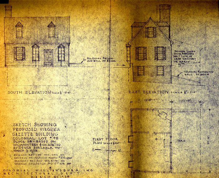 SKETCH SHOWING PROPOSED VIRGINIA GAZETTE BUILDING COLONIAL LOT #48 BLOCK 18-BASED ON
DOCUMENTARY & EXCAVATED EVIDENCE AVAILABLE ON MARCH 9, 1938.
SKETCH SHOWING PROPOSED VIRGINIA GAZETTE BUILDING COLONIAL LOT #48 BLOCK 18-BASED ON
DOCUMENTARY & EXCAVATED EVIDENCE AVAILABLE ON MARCH 9, 1938.