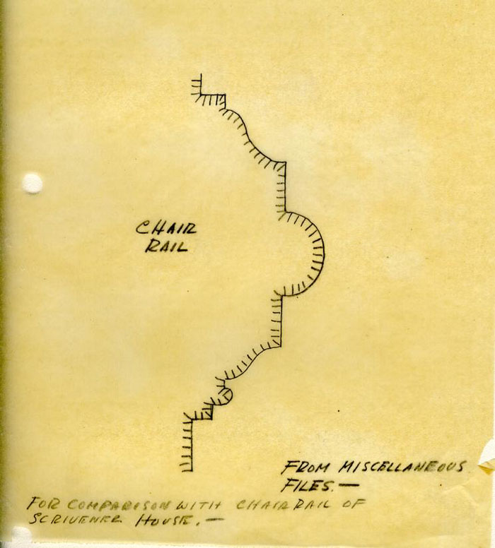
Scrivener Store Archaeological Report, Block 17 Building 30 Lot 56Originally entitled: "Archaeological and Architectural
Report Scrivener Site Block 17 Colonial Lot 56"
Colonial Williamsburg Foundation Library Research Report Series - 1373
Colonial Williamsburg Foundation Library
Williamsburg, Virginia
1990
ARCHAEOLOGICAL AND ARCHITECTURAL REPORT
SCRIVENER SITE
Block 17
Colonial Lot 56
Architectural Department,
Colonial Williamsburg
CHRONOLOGICAL SUMMARY
JOSEPH SCRIVENER Site
Block 17
Colonial Lot 56
| June 5, 1717 | Lot sold by William Wharton to John Marot. |
| 1745 | Western section 30 feet wide and eastern section 52'-0" wide held under separate titles - James Shields held western section. 30'-0" section to John Harmer. |
| June 17, 1745 | John Harmer sells his eastern portion to William Hubard. |
| June 17, 1749 | James Hubard sells his portion (eastern portion) to Henry Wetherburn. |
| June 15., 1760 | Wetherburn Possibly conducted his tavern on this site, for when he sold he describes himself as a "Tavern Keeper." He sells to Dr. William Pasteur. It appears Wetherburn had added 9'-0" from adjoining lot #57 - as he sells 61'-0" to Pasteur. |
| July 19, 1760 | Dr. Pasteur subdivides his lot into two portions 177'-0" from Nicholson Street toward Duke of Gloucester Street sold to William Holt. Smaller lot sold to four merchants, "Miller & Company." |
| 1761 | During this year it seems probable that "Miller & Co." operates a shop on this site. At this time Dr. Pasteur was next door. (See page 8 Report: Va. Gazette adv.) |
| May 12, 1773 | The two lots belonging to Holt and Miller & Co. sold together to Robert Nicholson. (The easterly portion of the eastern section). Pasteur still owning his west portion. |
| At this time Scrivener still uses west portion belonging to James Shields, infant. | |
| April 17, 1779 | Robert Nicholson deeds this property to his son. At this date Dr. John Winson Gault had bought Pasteur's part to the west. (See Deed page 9 - Research Report.) |
| July 10, 1789 | Known to have been still owned by William Nicholson. |
| 1790 | Some confusion seems to be apparent in ownership of Lot #56. |
| 1800 | It is possible the Greenhorns family owned the easterly |
| 2 | |
| part of the original lot #56 and the Galt family still held the western portion together with part of Lot #55. | |
| The ownership from this date onward is fragmentary due to the loss of the James City records. | |
| The Western Portion of this Eastern Section | |
| Pasteur continues to use his lot for 18 years. | |
| 1760 - 1775 | Pasteur operates apothecary shop. |
| 1775 | Pasteur and Gault form partnership. |
| 1778 | Pasteur sells property to his former partner, Dr. Gault. |
| April 16, 1798 | Dr. Gault deeds land & shop to his son, Dr. Alexander Dickie Gault. |
| 1745 | "----all which ground formerly belonged to John Marott." |
| "and all houses, buildings----." | |
| Page 3, Research Report. | |
| 1749 | Eastern portion probably occupied by house as Wetherbon's Tavern. |
| 1760 | Wetherbon sells to Dr. Pasteur. |
| "----and all houses, outhouses, yards, garden----." | |
| 1760 | Dr. Pasteur sells north portion to William Hold |
| "with all edifices, buildings, yards and appurtenances----." | |
| Page 7, Research Report | |
| 1760 | Dr. Pasteur sells south portion to "Miller & Co." |
| "----and all edifices,,, buildings,, yards, gardens, ways, waters----." |
| £-40 | 1717 | Title of lot 56, with "mansion or dwelling house thereon now standing," passed from William Wharton to John Marot, who died the same year. The 30-foot wide strip on the west was inherited by his daughter. Edith,? see p. 5 whose husband was Samuel Cobbs, including "all houses, buildings ...." |
| 5s | 1745 | Western 30 feet of lot 56 deeded to James Shields, ordinary keeper, husband of Anne another daughter of see o, 5John Marot. |
| 1760 | Western thirty feet "belonging to James Shields, an infant, and now in the occupation of Joseph Scrivener..." | |
| £350 | 1762 | Joseph Scrivener bought the western 30 feet "and all houses, outhouses, buildings..." |
| August | 1772 | Scrivener's death. Inventory of stock in trade and personal effects. "Mr. Joseph Scrivener, of this city, Merchant; who will long be remembered for his many good Qualities, and the Loss of Him often regretted by the Lovers of a Social Evening and a Cheerful glass." * |
| C.1786 | Evidence of Frenchman's map is inclusive. ** | |
| 4 | ||
| C.1800 | Bucktrout, Bucktrout-Lively, and the Unknown Draftsman's maps show "Galt" in Lot 55 and "Greenhow" in Lot 56. But actually the Greenhow holding seems to have comprised only the eastern portion (about one-third) of Lot 56, while Galt's property seems to have included the remainder of lot 56 (including the Scrivener house),as well as lot 55.* | |
| 1806 | Greenhow insurance policy No. 645 (reversed from east to west?) refers to "Dr. Galt's shop" next door. | |
| 1815 | Raleigh Tavern insurance policy No. 1517 shows "Galt's lot" next to east of Raleigh Tavern lot. | |
| 1900 | Scrivener house was still standing, for it appears in a photograph, (N6079) belonging to Miss Lucy Vaiden which, she states, was taken some time after 1900. The view is from a point opposite the Vaiden House. Another photograph taken from a point opposite the Lee House, (copies are on file in the Department of Research and Record) seems to be of approximately the same period. | |
General Description
The chain of titles listed in the Chronological Summary, interpreted according to measurements taken on the ground, clearly identifies the site immediately east of the Vaiden house with a 30-foot strip constituting the western portion of Colonial Lot 56. This strip, running through from the Duke of Gloucester to Nicholson Street, was divided from the rest of the lot, after the death of John Marot in 1717 (seemingly, according to the terms of his will). At the tine of the division a "mansion or dwelling house" was standing somewhere on Lot 56.
By a deed of 1745*, title was transferred from Samuel Cobbs, gentleman of Amelia County, to James Shields, ordinary keeper. The consideration was a nominal 5 shillings. Cobbs and Shields were the husbands of two of Marot's three daughters, among whom the father's real estate had been divided (if the terms of his will were carried out). If, as seems probable, Anne, wife of Samuel Cobbs, had inherited the western strip of lot 56 in 1717, it is to be presumed that she had not resided on this property for an unknown period prior to 1745, since Cobb's address is given in that year as Amelia County. The wording of the deed indicates that Shields was already "in the possession" of the property although his residence was on the other side of the street. It is possible that he was already operating an ordinary, perhaps in the "mansion" of 1717.
By 1760 the strip was "in the occupation of Joseph Scrivener,"** merchant. Scrivener purchased this property in 1762 for the large consideration of 350 pounds.
6Scrivener carried on general trade until his death in 1772. Later - at an unknown date - Dr. John M. Galt seems to have become the owner, and still later perhaps his son, Dr. Alexander Dickie Galt.
On excavation ( in 1939-40), two early foundations of different periods were found at the south end of the strip.
The earlier is that of a long narrow building with its long axis from north to south. This may be tentatively identified as the "mansion" mentioned in 1717.
The later is a square foundation with interior piers which indicate a cross-wall toward the rear. This can be positively identified with the dwelling shown in two photographs (N6079 and N6080).
The exact date when the first building was supplanted by the second has not been established. But values of the property on at least two dates are known, and these provide at least some slight basis for judgment. In 1717 Marot paid only 40 pounds for the whole of Lot 56 with a "mansion" to boot. But by 1762 the western strip alone, with its "houses, outhouses, buildings..." was worth 350 pounds to Joseph Scrivener. Such a substantial increase in value shows that the dwelling of 1762 must certainly have been built since 1717, and creates a strong presumption that it was built later than any of the "houses, buildings," etc., that may have been standing in 1745* (since the sale price of 1762 would seem to indicate a strictly new building).
7The latter buildings are the first ones mentioned as standing on this particular property. The "mansion" mentioned in 1717 may have been located anywhere on Lot 56. Further conjecture as to the earliest structure or structures on the western strip would be premature at this time when it is not yet possible to explore the site of the existing Lee House for comparison.
In summary, it seems possible that the early long structure, used as an ordinary by Shields for an unknown period, was replaced not long before 1762. The later structure, used by Joseph Scrivener as a dwelling and a store until his death in 1772, is represented by the square foundation shown in the Archaeological drawing, and is identical with the story-and-a-half structure of Photograph N6079 and N6080.
The location of the east and west property lines rest upon indirect but substantial evidence. Two deeds of 1745 give the frontage as 30 feet. In subsequent records throughout the colonial period there is no indication of any alteration in the width, which indeed might be expected to become more definitely fixed after the erection of buildings.
In the Archaeological Report on the Vaiden site, the question of boundaries in Block.17 was discussed at some length. The east end of the Vaiden house* was found to be the most likely location of the east line of Lot 55. Other lines in Block 17 derived from this line (using an interval of 82½ feet) produced the smallest number of discrepancies.
If the same line is taken as the west boundary of Lot 56, a thirty-foot strip east of it would fail by only two inches to reach the east line of the square Scrivener foundation. An error as small as this might easily be attributed to careless or unskillful. measurements.
8East of the Scrivener foundation, and separated from it by a space of only two inches, is the 13-inch-west wall of a large early foundation. The northwest and southwest corners of this foundation were located during the excavation of Area G, but the north and south walls could not be traced farther eastward because of the nearness of the existing Lee House. The identity of this foundation is not known. Its west line provides a probable east limit for the east line of the Scrivener property, confirming in substance the evidence of the Scrivener foundation itself.
Detailed Descriptions
G-2 See Photographs N6117, N6122, N6137-40 incl., N6150.
Early Foundation
13-inch brick footings at grade level could be traced for most of their original extent by brickwork or fill. Only the south wall had disappeared entirely. Indications were of a building 20 feet wide from east to west and at least forty feet long from north to south. If the south wall was on the building line, the length was nearly or exactly 50 feet. The foundation bears three degrees off perpendicular from the street line, the variation being to west of north. Aside from the early character of the brickwork, sufficient evidence of the priority of this foundation is the fact that the other foundation is built on top of it wherever crossing occur.
Nothing is known of the history of the building on this foundation, beyond the fact that its date was considerably earlier than 1762 and probably earlier than 1745. Nothing whatever is known of the probable form of the structure above ground.
| Brick | - 8-¾"x4¼" x 2½" |
| Mortar | - Shell |
| Condition | - Bad |
| Bond | - English |
G-2 - Later Foundation (N6117, N6122, N6137, N6138, N6140, N6150).
A 9-inch brick footing 26 feet square straddles the long narrow foundation described above. The brickwork is of early character, but is plainly later than that of the long foundation, being built over it at the only two points where crossing occur.
The east, west, and south wall footings are at grade level. A basement had been dug out, leaving earth banks a short distance inward 10 from the footings. The remnants of the earlier foundation remained on the high level. The basement depression extended as far as the north wall, which accordingly had its footing at the basement floor level. An exterior basement entrance bulkhead was at the center of the north wall (N6150). Some brickwork remains of the lowest two steps and the flanking walls. Apparently the bottom step had a wood nosing and the second step a soldier-course brick nosing.
The south wall is on the building line, the west wall cleats the Maiden house by 4 feet, and the east wall is within 2 inches of a large unidentified early foundation.
Foundations of two brick piers just north of center (N6140) presumably indicate a cross wall.
This building is known from photographs (H6074-80) to have had an A roof with typical steep pitch in front and a long rear slope. Such a roof might have developed from a typical A roof, with a steep pitch front and rear, if it was later extended on the rear and rebuilt with a continuous slope from the old ridge to the new rear eaves - one result being a flatter slope. (Such a development probably occurred in the case of the Vaiden House, among others.)
But existing evidence in the Scrivener foundation gives no indication that such development took place here. There are no traces of a continuous wall on the line of the intermediate piers. There are no breaks, or evidences of corners, in the east or west walls on or near the same line. According to the evidence available, the building was first erected as a square.
Ordinarily it would seem surprising that an asymmetrical roof scheme should have been adopted for a new house in this period. But in 11 this case it is probable that the adjacent Vaiden house had an asymmetrical roof developed as outlined above (probably before 1752) by a rear addition to the house. Here might be a strong suggestion and incentive to make the new Scrivener house conform to the same design.
Surprisingly, no traces of a chimney were found at any point in Area G-2. It is positively known from the photographs (N6079-80) that a chimney stood north of the west end of the roof ridge of the Scrivener House. At the time of the photograph, it had been extended upward far enough to clear the roof of the two-story Vaiden house. Miss Vaiden has described this chimney as centered on a cross partition (which may have been a partition above the two interior piers), and as having two corner fireplaces on the first floor. There is no evidence that this was not the original chimney. The most likely explanation for the absence of traces of it is that the whole of it was salvaged including the base-course.
The photograph shows that there were two windows on the main floor front, a door on the east, and three front dormers. There were no windows in the east wall, and none in the east wall, and none in the visible (front) portion of the west.
A patch of foundation was found outside the south wall line, near the east end--doubtless a remnant of the front steps.
| Brick | - 8½x 4" x 2-¾" |
| Mortar | - Shell |
| Condition | - Bad |
| Bond | - English |
The foundation was later extended northward for 3½ feet (N6117, N6122, N6137, N6150). Apparently at the same time, two piers were built against the inside of the old north wall,, one of them partly 12 against the old entrance steps (which were probably closed up in any case by the new north wall). The brickwork is of a late character, laid in lime mortar.
The first G-2 seems better adapted by its shape than the second to serve either as an ordinary (Shields) or as a store (Scrivener). But no conclusions should be drawn from this unsupported fact, since both ordinaries and stores are positively known to have existed also in structures like the second G-2. The structure of Photographs 6079-80 (presumably the second G-2) seems to have generally early characteristics in plan, proportions, and details. This in itself is by no means conclusive evidence, yet it seems to deserve greater consideration in the light of the fact that Joseph Scrivener is the last known occupant of the property who appears likely to have erected a building of an early type. (See Chronological Summary). On the whole perhaps the most likely theory is that the first G-2 may have served as Shield's ordinary, and the second G-2 as Scrivener's dwelling and store.
Kitchen, Smokehouse, and Dairy (Area G-6)
Beginning at the northwest corner of the first G-2, and continuing in staggered formation to the northeast, is a series of three out-building foundation which seem to represent respectively a dairy, a smokehouse, and a kitchen.
Dairy
The first of 9" brickwork, 8 feet square, was tangent to the northwest corner of the first foundation G-2. Therefore, it did not co-exist with the latter and may be assumed to have followed it and to have served as an outhouse for the structure on the second G-2.
There is no evidence of a floor.
13The size is that of a smokehouse or a dairy. Since the smokehouse for this group is accounted for (see below), this may reasonably be taken as the dairy.
| Brick | - 8-¼" x 4" x 2-¾" |
| Mortar | - Shell |
| Condition | - Bad |
| Bond | - English |
Smokehouse (N6136, N6149)
The next foundation is also of 9-inch brickwork, and (like the dairy) 8 feet square. It is separated from the dairy by 2½ feet, and centered about 5 feet farther east. The floor is of brick, laid flat in shell mortar, and almost intact except for wear in the northeast corner and a narrow modern pipe-trench at center. At center is a circle of half-bricks, surrounding a fire-pit six inches deep and paved with brick laid flat diagonally.
The floor is about six inches above the probable level of the original grade.
The fire-pit is definite evidence that this is the foundation of a smokehouse.
| Brick | - 8½ x 4" x 2-¾" |
| Mortar | - Shell |
| Condition | - Poor |
| Bond | - English |
Kitchen (N6135, N6139)
The kitchen (12 x 16 feet) is just northeast of the smokehouse, from which it is separated by less than 2½ feet measuring diagonally between the nearest corners. The chimney is outside the west end, and is of brickwork 1½ feet thick enclosing a fireplace over three feet deep and nearly fire feet long.
The northwest corners of the dairy, the smokehouse, and the kitchen chimney line exactly if allowance is made for the projection of the corner boards of the two former.
14The 9-inch wall footings are of two periods. The later footings are those towards the eastern end. Apparently the grade level around the kitchen had risen*, and it was necessary to raise the level of the footings. The later footings are at a higher level than the earlier, upon which they rest at two points.
The later footings do not quite follow the line of the earlier ones; the east end is swung nearly a foot farther to the north.
| Brick | - Mixed sizes, salvaged |
| Mortar | - Lime |
| Condition | - Poor |
The earlier wall footing, like the chimney, appears to be of the same period as the dairy and smokehouse.
| Brick | - 8¼" x 4¼" x 2-¾" |
| Mortar | - Shell |
| Condition | - Poor |
| Bond | - English |
The chimney has its base at a level more than a foot below the bottom of the wall footings. It appears to be the only foundation in Area G-6 which is based directly on hardpan.
The only trace of paving is a hardened area of crushed brick about the level of the top of the later footing. It seems probable that the floor was built up to this level at the time the footing was raised. But if so, the change cannot have been great: The two footings differ in level by only two courses.
However., no evidence of another floor was found.
It in not certain whether or not the floor was ever paved.
A layer of burnt earth inside the fireplace, five inches below the abovementioned floor level, may have been an extension of the original 15 floor. But it seems equally or more probable that paving may have covered the earth floor here from the first. (Burnt earth could easily have sifted through such paving.)
The three outbuildings of Area G-6 appear to be of the same period (except for the later alteration to the kitchen).
The brickwork appears to be of the same period as that of the later foundation of G-2, and different from the earlier foundation. It is unlikely that the dairy (and consequently the two other outbuildings of the same group) were standing at the same time as the earlier G-2, for the southeast face of the dairy would have touched the northwest face of the larger building.
On the whole there seems to be little doubt that the kitchen, dairy, and smokehouse are all of the period of the later square foundation G-2.
The absence of a well on this site is noteworthy. The occupant of the property might easily have been permitted the use of wells on the Maiden or the Lee property. The latter seems the more likely, but no decision on this point is to be expected pending excavation of the Lee property.
Sources
General material on Block 17 has been listed in Archaeological Report on the Vaiden Site. Relating specifically to the Scrivener site, or to Colonial Lot 56, are the following:
- Archaeological Drawing - "Southeast Corner of Vaiden Lot" -J.M.K., 3/2/40 (A copy is incorporated herewith).
- (See new drawing, Colonial Lot #56, Scrivener.)
- Report of the Department of Research and Record: "Lee House," no date: letter attached, dated 12/7/39. (A copy is on file in the Architectural Department)
- Photographs:
N6079-80
N6117
N6122
N6135-40 incl.
N6149-50.