Block 14 (Part - Bryan Lot) Archaeological Report, Block 14Originally entitled: "Archaeological Report Block 14, Area B-2 (17th Century Foundation Under Nassau Street)"
Colonial Williamsburg Foundation Library Research Report Series - 1286
Colonial Williamsburg Foundation Library
Williamsburg, Virginia
1990
ARCHAEOLOGICAL REP0RT
BLOCK 14, AREA B-2
(17th Century Foundation Under Nassau Street)
During the archaeological investigation of the Bryan Lot in October, 1940 the foundation of a very early colonial building was discovered. This foundation was only four feet from the southeast corner of the Bryan House foundation, lying partly in Nassau Street and partly in the Bryan Lot. Only the portion in the Bryan Lot was excavated in October, 1940, because of the impracticability of closing and barricading Nassau Street at that time. In April, 1942, permission was granted by the city to close a part of the street for further investigation of this foundation. This work was done at once and the area backfilled as soon as all available data was secured.
The foundation was of a 43'- 7" x 19' - 4" brick building determined by the wall thickness. A large amount of broken brick and shell mortar composed practically all of the basement fill. It had a full basement with the western half paved with well-preserved brick. No evidence of brick paving in the eastern half was discovered. There was an inside chimney on each end, of which the eastern chimney appeared to have had a basement fireplace. This was proven by the presence of a layer of wood ashes as well as by the fact that the brickwork of the sides and hearth showed signs of exposure to fire. No indication of fire was discovered in the western chimney so that the chimney mass above (now missing) was supported originally on a relieving arch. Thus this end probably did not have a fireplace other than on the first and second floors. It is to be noted that the foundations of these chimneys do not center in the building, but are slightly to the south of the centerline. (See Archaeological Drawing, Block 14, Area B-2).
2Entrance steps to the basement were located on the east end near the northeast corner. Several bricks which were remains of the bottom tread and a strip of shell mortar which showed the imprint of the wood nosing were exposed. 911 other evidence of the steps had been destroyed.
The wall thickness of this foundation ranged from 18 ½" to 19", with the bottom course acting as a 22" spread footing. Very few whole bricks were used in the interior of the wall. It would appear that in order to utilize the bats and broken bricks, these were employed as fillers for the inside of the wall while the whole bricks were used on the interior and exterior face. (See section A-A on Archaeological Drawing.)
No evidence of outside steps to the first floor could be found on either the north or south side of the building. These were probably destroyed when the building was demolished and all traces of them have since disappeared.
| "Brick size | -9" a 4" x 2 ½" |
| Color | -Light reddish buff |
| Bond | -English |
| Mortar | -Oyster shell |
| Condition | - Fair |
See Photographs N-6531, N-6553, N-6882, N-6883, N-6884, and N-6885.
The artifacts found in the basement fill were composed mostly of broken ale bottles and pieces of lead came. The ale bottles were of the early colonial variety, very similar to those found at Jamestown, Virginia. Practically all of the lead cames were found in two locations within the basement. In the central portion of the paved area were found almost the complete remains of the lead work of an early leaded glass window lying flat on the paving. There were also many broken pieces of window glass which originally formed small rectangular and diamond-shaped panes. This window has been restored and will be placed in the Old Court House Museum. About five pounds 3 of lead cames were found in the extreme southeast corner of the basement, in so damaged and distorted a condition, however, that it was impossible to restore original shapes or sash sizes. Several pieces of broken clay pipe were also discovered among the debris of brick and mortar. Very few pieces of broken china or earthenware were found, and from the general appearance, it seems that this basement was cleared of all contents or rubbish, before the building was demolished.
There being no record of any structure on this site it is almost impossible to state what dwelling this was or arming in regard to its early ownership.
The building that was here was not parallel or perpendicular to any of the Williamsburg street lines and it originally faced either NNW or SSE.
In the seventeenth century when the early settlers first began to inhabit Williamsburg, then known as Middle Plantation, there was a traveled way or road on the peninsula known as the "horse path." This travelled way followed the high ground or ridge between the ravines that drained to the York and James Rivers. Should this road be laid out again along the ridge, the seventeenth-century building foundation would be on the south side and practically parallel to it with the NNW side of the building as the front.
It may be mentioned that the early church foundation located in Bruton Churchyard and uncovered in 1938 would be just to the north of the road as it winds eastward.
James M. Knight
Colonial Williamsburg
Architectural Department
September 4, 1942
 [Blueprint]
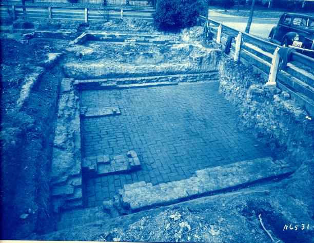 Photograph N6531
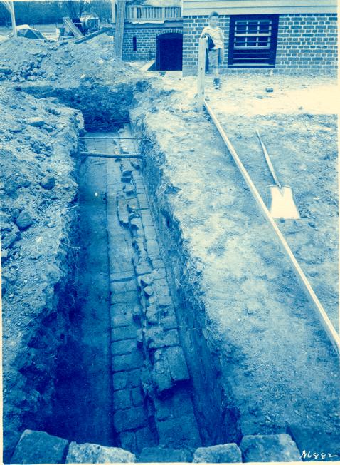 Photograph N6882
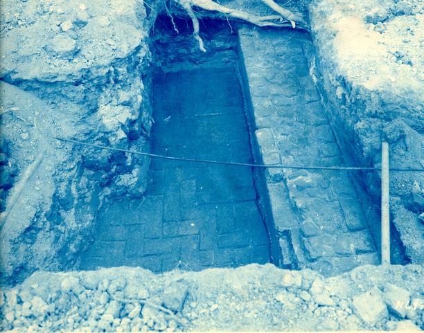 Photograph N6883
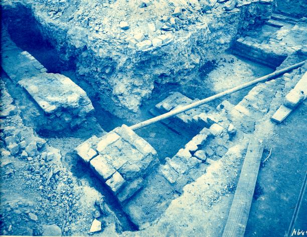 Photograph N6884
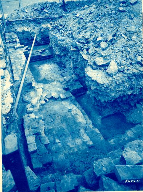 Photograph N6885
Archaeological Survey of Foundation of 17th Century House Located Just S.E. of Bryan House. Williamsburg, VA.
Digital version unavailable.