Capitol Landscape Architectural Report Block 8 Building 11Capitol Grounds
Colonial Williamsburg Foundation Library
Research Report Series - 156
Colonial Williamsburg Foundation
Library
Williamsburg, Virginia
1990
CAPITOL GROUNDS
June 15, 1942
This study is presented in the hope that, as time goes on and as conditions allow, the Capitol grounds and its immediate surroundings may be ultimately restored to the condition that existed in the 18th century, and also that modern necessities such as parking spaces may be planned and located so as to do as little hurt as possible to the picture as a whole.
Encroachments
Since, the "bounds" of the Capitol were established by law in 1704 (See Plan of Prison Bounds - Plan A) many encroachments inside these limits have occurred, all of them but one subsequent to 1782. That one, as established by the Frenchman's Map, includes the group of buildings in the extreme North East corner now known as the Coke-Garrett House. How and why this particular encroachment occurred would be an interesting subject for further study but hardly of immediate concern to us as it would by hard to find anyone advocating the removal of an 18th Century house in order to restore the Capitol grounds to an only slightly earlier period.
The encroachment by the Vest property on the west is a more debatable subject for this was a 19th Century trespass. But here the encroachment is very slight and the house itself in its present state is such a fine architectural example that again few advocates are likely to appear in favor of the removal of one third of its bulk in order to restore it to its 18th Century condition.
All other 19th and 20th Century private property encroachments except two have already been eliminated so they need not concern us here. These two are the modern dwelling attached to the Clerk's Office and the unowned property within the extreme north west corner of the Capitol bounds. The first of these presents no problem for it is a life tenancy and will ultimately be removed. The second is not at present serious for there are no buildings on that part of the property within the Bounds. It contains, however, the site of the Prison spring, traces of which have been found by excavation. Its ultimate acquisition would therefore be desirable.
The most serious encroachment of all is that by the City of Williamsburg, namely that portion of Nicholson Street which detours around the Prison within the lines of the Capitol Grounds.
It is clearly evident that in the 18th Century, the junction of Nicholson Street across the Capitol Grounds was neither carried out nor even considered.
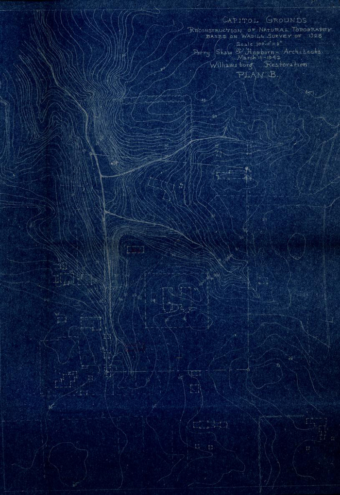
First - The prison was built on the centre line of this street. The modern serpentine road, to avoid the prison, would never have been considered by the 18th Century city planner who had adhered universally elsewhere in the City to rectilinear lines. An addition to the Prison made in 1772, the foundation of which has been uncovered, projected 31'0" into the present road, showing conclusively that this road could not have existed at that time. Second - the Frenchman's map shows two gullies across the line of this street. If there had been a traveled way there the gullies would have been shown interrupted like the North South gully interrupted by the Duke of Gloucester Street. (Note this gully used to run clear across the street as far as the Galt property. See study of original topography, Plan B) Third - These gullies are too deep in their natural state to have been negotiable by wheeled vehicles.
Apparently, however, the extreme easterly end of Nicholson Street in front of the Coke-Garrett House to its junction with Waller Street was established about the middle of the 18th Century. This is clearly indicated by evidence submitted by the Research Department (Copy attached).
In advocating the closing of Nicholson Street within the limits of the old Capitol Bounds we are fully aware of the difficulties which the closing of a modern traffic artery (although a minor one) would create. Abutters on this street whose property is not controlled by the Restoration would have a grievance.
It is possible that the closing of Nicholson Street as a though way might tend to throw more traffic on to the Duke of Gloucester Street. This would be a most undesirable result but might be overcome perhaps by the construction of a new road from the dead end of Nicholson Street running north to join Lafayette Street. (See dotted lines on Plan C)
In spite of the very real difficulties we nevertheless feel that this aspect of the Restoration of the Capitol Grounds is of sufficient importance to warrant the most careful consideration by all concerned. To restore the contour of the ground comes only next in importance to the restoration of the building themselves.
Parking Space
There seem to be six available locations for a permanent parking space near the Capitol; five on Waller Street, A - B - C1 - C2 - D, and one on Francis Street, E. (See Plan C)
All of these locations were sites of Colonial buildings. Site B however seems to have had but one small outbuilding as indicated by the Frenchman's Map. Site A is somewhat remote and its use as a parking space would injure the setting of the Garrett House. Sites C1 and C2 had several Colonial buildings on each one so that their use as a permanent parking space could prevent ultimate restoration. Site D was an important colonial residence and its commanding corner location would make its use as a parking space highly undesirable. Site E had colonial buildings and is somewhat remote. Site B seems to offer the best ultimate location for a permanent parking space near the Capitol. It is readily accessible from Francis Street and Lafayette Street via Waller Street. There are no important Colonial buildings on its site and it can be easily and naturally screened from view by planting. Objection to this site for immediate use lies in the fact that it is subject to a life tenure that may not make it available for many years. Meanwhile an alternate site for present use is now available on Francis Street near the south end of Blair Street. (Site E)
Restored Grounds
Plan C shows the Capitol Grounds as they might ultimately appear, with restored topography north of the Capitol and with suitable paths leading to the Clerk's office, Prison, Parking Space, etc.
In colonial days the comparatively level space south of the Capitol and east of it leading into the east extension of the Duke of Gloucester Street was probably used for the passage of coaches and for the hitching of saddle horses and a general loafing space for slaves in attendance on the members of the General Court and the House of Burgesses when in session. It is probably unkempt with ragged grass patches and either dusty or deep with mud according to the season, and with no well defined traveled way.
To attempt to recall the use of this space by permitting the uncontrolled passage of modern vehicles would be to invite a condition even worse than that tolerated in the 18th Century.
It seems desirable however that a controlled passage for vehicles around the Capitol be established to recall in some degree at least the convenience of free travel that must have existed. To this end we suggest an informal gravel road as shown on Plan C.
Surroundings
The restoration of the colonial buildings on Francis and Waller Streets when and as policy permits will complete the restoration of this important area.
- A.Evidence in favor of an open Nicholson Street throughout its present length:
- 1.The Bucktrout Map of 1803
- 2.The Unknown Draftsman's Map
- 3.Isaac Weld, Jr. in his Travels Through the States of North America...1795-97 describe the streets of Williamsburg as follows, "The town consists of one principal street, and two others which run parallel to it."
- B.Evidence that Nicholson Street extended up to the Public Gaol, both from the West and from the East.
- 1.
Lots 802, 274, 275 and 276 in a deed of 1760 were described as being "on the north side of Nicholson Street" (York Co. Records Book 6, Deeds, pp. 400-402)
In 1775, John Coke received by deed lots 279 and 280 which property was described as "All those lots of half acres of land lying and being in the City of Williamsburg aforesaid on the North side of Nicholson Street bounded on the East by the lots* of the said John Coke and on the West by the lots whereon the Public Gaol is erected..." (York Co. Records Book 6, p. 15)
- 2.A plat made in 1749 of Williamsburg property east of the Capitol shows that Nicholson Street was open south of John Coke's two lots. The plat does not show Nicholson Street farther west than the two lots. (York Co. Records, Book V, Deeds, Plat Book #3)
- 1.
- C.Evidence in favor of Nicholson Street obstructed by the Gaol.
- 1.The Frenchman's Map (c1782) shows a ravine and the Gaol athwart the street.
- a.A deed of 1801 to Lot #262 reads as follows: "A certain house and lot of land lying and being in the city of Williamsburg and County of York, on the North side of the street running from Palace Street to the Jail..." (York Co. Records, Book 7, p. 405)
- 1.The Frenchman's Map (c1782) shows a ravine and the Gaol athwart the street.
BOUNDS OF THE CAPITOL AND PRISON
DOCUMENTARY EVIDENCE
April 11, 1930
- 1.Survey of Williamsburg by Theodoric Bland - 1699
- 2.Map of Williamsburg about 1790 (College Library)
- 3.April 1699. Session 11th William III Act XIV
Portion only quoted as followsII "Be it enacted, by the governor, council and burgesses of this present general assembly, and the authority thereof, and it is hereby enacted, that four hundred seventy five foot square of land, lying and being at the said Middle Plantation, which hath been already agreed upon by his Excellency the Governor, Council and Burgesses, of this present General Assembly, to be taken up and surveyed, as a convenient place for such uses, be the ground appropriated to the only and sole use of a building for the General Assemblies and Courts to be held and kept in:" Etc.
- 4.Wednesday May the 3rd, 1704
Portion only quoted as follows"That ten acres of land be laid out for the bounds and rules of the Prison" Journals of the House of Burgesses of Va. 1702-1712 p. 64-65
- 5.Wednesday May the 10th, 1704
Portion only quoted as follows"Resolved: That the Publick Prison be included within the Bounds appropriated to the Capitol and that the sd. bounds already ascertained for the s'd Capitol be continued from the main road just before the door of one of the Capitol Houses to the extent of forty one poles to a post, thence including the prison, thirty two poles to a post on the west side of the Spring, thence fourteen poles to the corner of a Ditch, thence along the said Ditch thirty poles and a half to a post by the said Ditch, and from thence to the beginning place."
W. Randolph Cl: Ho: Bur:
INTERPRETATION OF EVIDENCE
- A.There seems to be no doubt about the "four hundred seventy five
foot of land" surrounding the Capitol itself.
These boundaries coincide in a very significant manner with existing property lines and fences, notably on the east and west sides.
The dotted square A B C D ON THE MAP SHOWS THESE BOUNDS. - B.
No. 4 appropriates ten acres for the Bounds and Rules of the Prison and No. 5 states that "the Publick Prison be included within the Bounds appropriated to the Capitol."
It therefore seems reasonable to suppose that the "ten acres" would include the Capitol grounds as well as the Prison grounds especially as ten acres for the Prison alone would be unreasonably large. Larger in fact than the Capitol grounds.
- C.
If the "Spring" (mentioned in No. 5) could be located there would not be much doubt as to how the bounds were laid out.
There seems to be no evidence at present of any spring in the vicinity of the Capitol but the 1790 Map (No. 2) shows on lots 276 - 277 "Greenhow" a spring"
These lots join the Prison lots on the west.
- D.
It should be borne in mind that the Bland Survey (No. 1) shows the Duke of Gloucester Street running some distance east of the Capitol. Therefore "the main road just before the door of one of the Capitol houses" (No. 5) might refer to either the west or east sides of the building.
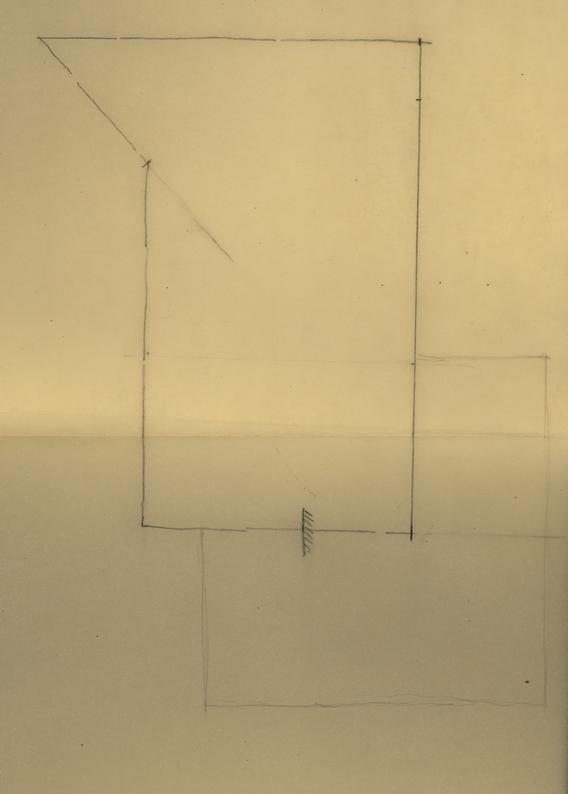
Given the 475 foot square around the Capitol, if the side A-B on the east is prolonged to the north to an extent of 41 poles (676 feet) we reach a point E (at the N.E. corner of the present Garrett house). From this point as a centre an arc is swung to the west with a radius of 32 poles (528 ft.)
If the west side of the 475 foot square is prolonged to the north to an extent of 30 ½ poles (503.25 ft) we reach a point G. From this point as a center an arc is swung to the north with 14 poles (231 ft.) as a radius. The intersection of this arc and the former one fix the point F., which falls inside the Lots 276-277 where the spring was noted on the 1790 Map.
In reading the description (No.5) of the bounds once again it will be seen that every landmark (except the posts) seems to be accounted for by this diagram "The post on the west side of the spring" (Point F) seems properly located; "thence fourteen poles to the corner of a Ditch" (Point G) falls near the intersection of two small ravines (see contour map) "Thence along said ditch thirty poles and a half to a post by the said ditch (Point D)" follows the present small ravine perfectly, crossing where the modern Duke of Gloucester Street has filled it in; "from thence to the starting point" brings us back to A, along the southern boundary of the Capitol grounds.
This diagram A E F G D - A encloses an area of about 8 acres modern measurement. We have so far been unable to find out if the acre of 1704 was the same as at present, namely 43,560 sq. ft.
Perry, Shaw & Hepburn
Footnotes
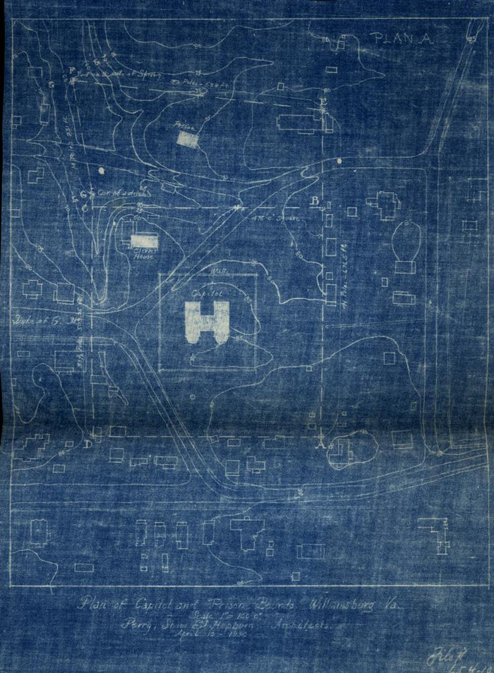 Plan of Capitol and Prison Bounds, Williamsburg, Va.
 Capitol Grounds
Reconstruction of Natural Topography Based on Wadill Survey of 1928
 Study for [illegible] Development of Capitol Grounds