Elkanah Deane Hosue Archaeological Report, Block 30-2 Building 1AOriginally entitled: "Briefing on the Archaeological Potential of the Elkanah Deane Site"
Colonial Williamsburg Foundation Library Research Report Series - 1598
Colonial Williamsburg Foundation Library
Williamsburg, Virginia
1990
BRIEFING ON THE ARCHAEOLOGICAL POTENTIAL OF THE ELKANNAH DEANE SITE
INTRODUCTION
The Elkanah Deane property (Figures 1 and 2) lies on Block 30-2 along Prince George Street, between Palace Street and a large ravine east of North Nassau Street. It includes Colonial Lots 330, 331, and 332, and can be divided into three main areas: the Deane House and nearby outbuildings, at the corner of Palace and Prince George Streets; the Deane Garden, between the house and a gravel driveway leading to the Robert Carter Stable and Chariot House; and Deane Shop and Forge, an exhibition building lying west of this driveway (see Figure 3).
The Deane House (Bldg. 1-A) is a fenced-in private residence with associated Kitchen (Bldg. 1-B) and Wellhead (Bldg. 1-D). Most of the area directly behind the house is covered with a brick platform that extends to just west of the kitchen and wellhead.
Immediately west of these two outbuildings is the Deane Garden. The garden is presently open to the public and contains approximately 5500 square feet of shrubs and flowers, along with three small outbuildings-- two privies (Bldgs. 1-F and 1-G) and a woodshed (Bldg. 1-H). Brick paths subdivide the garden and provide access to the small outbuildings in the yard. The potentially undisturbed areas beneath these brick paths may contain useful archaeological information for the correct interpretation of this property.
The Deane Shop and Forge area is composed of the Shop and Forge itself (Bldg. 1-C), a wooden post-supported Forge Shelter (Bldg. 1-K), and the Servant's Quarters (Bldg. l-E). This area is also open to the public and presently contains a blacksmithing exhibition. When in Deane's possession, however, the shop was that of a coachmaker and was used for woodworking, harness making, and painting and finishing as well as blacksmithing (Letter from Edward P. Alexander to Cocke, Kendrew, Graham, and Harbour, November 20, 1962). The interpretive use of this building for blacksmithing was considered temporary until James Anderson Forges could be completed (Letter from A.E. Kendrew to Cocke, Graham, Harbour, and Alexander, November 20, 1962), and a re-evaluation of the property could yield more accurate insights about the activities that really occurred there.
Property History
The following property history is based on information from three research reports (Bullock 1931; McWilliams 1944; Stephenson 1956).
2
 Figure 1. Present-day view of Deane Garden from the east, with Deane House and Kitchen in background. Photo K62-JC-176.
3
Figure 1. Present-day view of Deane Garden from the east, with Deane House and Kitchen in background. Photo K62-JC-176.
3
 Figure 2. Deane Garden with brick paths separating planted areas. Photo 49-W-575.
4
The first known mention of this property was in 1720), when the city trustees deeded Lots 331 and 332 to John Holloway in consideration for five shillings. The standard building Clause was included, requiring that Holloway build a house on the premises within 24 months or the property would be escheated. Since there is no record that the land was forfeited, it is assumed that Holloway built a structure in the required time.
Figure 2. Deane Garden with brick paths separating planted areas. Photo 49-W-575.
4
The first known mention of this property was in 1720), when the city trustees deeded Lots 331 and 332 to John Holloway in consideration for five shillings. The standard building Clause was included, requiring that Holloway build a house on the premises within 24 months or the property would be escheated. Since there is no record that the land was forfeited, it is assumed that Holloway built a structure in the required time.
No further mention was made of the property until 1759, when Lots 331 and 332, along with Lots 329 and 330) (to the west), were sold to Dr. William Carter. Immediately before this time the land was apparently owned by Colonel John Chiswell. Chiswell was a member of the House Of Burgesses until 1758, but in 1759 he and several partners discovered a lead mine in Augusta County. He went to England to negotiate a deal, and apparently was by then ready to sell his Williamsburg property. In any case, his son-in-law, Speaker of the House of Burgesses John Robinson, appears on a 1759 deed transferring the land to Carter.
The next mention of the land was in 1761, when Dr. Carter got into a dispute with his neighbor to the north, Robert Carter of Nomini Hall. William Carter claimed a certain amount of land on the north side of Robert Carter's palings, but for a consideration of five shillings was persuaded to abandon his claim.
Dr. Carter mortgaged his property in June 1767 to his brothers, surgeon James Carter and merchant John Carter. In this deed he granted to them "All those four Lots of ground in Palace Street in the city of Williamsburg whereon the said William now lives..."(York County Records, Deed Book VII: 300). This is the first definite mention that William Carter was actually living on the property.
A fire in Dr. Carter's stable in July of that same year was reported in the Virginia Gazette (Purdie & Dixon, July 30, 1767). Apparently only the stable was destroyed, since fortunately there was little wind on that evening.
In late 1768 Dr. Carter offered his house for sale (Virginia Gazette, Purdie & Dixon, December 15, 1768):
5To be sold, on very reasonable Terms, for Cash, on 3 or 4 years credit, paying Interest for the Money .
The Dwelling-House in Palace street, with four Lots of Ground, well enclosed, and in good repair where the subscriber now lives. There is no situation in this city superior to it, for pleasantness and convenience.
WILLIAM CARTER
Carter does not seem to have been able to sell his"superior" property until 1772, when coachmaker Elkanah Deane purchased it for 700 pounds (York County Records, Deed Book VIII: 238) Deane, apprenticed in Dublin to noted coachmaker Joseph Carncross, had previously worked in Ireland and New York. Somewhat famous in his own right he boasted that he "had the Honour of making a Coach, Phaeton, and Chaise, for his Excellency the Right Honourable the Earl of Dunmore" (Virginia Gazette, William Rind, June 17, 1772).
When he bought the property he began advertising for customers. He stated that he proposed "to make and repair all sorts of coaches, landaus, chariots, postchaises, curricles, chaises, and chairs with harness of every sort. Also steel springs, and iron work of every kind, relative to the coachmaking trade. Likewise painting, gilding, and japanning" (Virginia Gazette, William Rind, May 21, 1772). In addition, he had "two or three spare rooms, [where he] Would be glad to accommodate Gentlemen with private lodgings" (Virginia Gazette, William Rind, May 21, 1772).
Another coachmaker in town, Peter Hardy, once worked for Deane but soon became a bitter rival. He began referring to Deane as "an Hiberian cottager" and "the Palace Street Puffer" (Virginia Gazette, Clementina Rind, October 28; November 11; November 18; December 2, 1773).
When Deane died around October of 1775, his widow Elizabeth offered the property for sale. In this advertisement (Virginia Gazette, John Pinkney, October 26, 1775), she states:
To be SOLD or RENTED,6
The HOUSES and LOTS of the late Elkanah Deane, pleasantly situated in Palace street, in this city. There is a well of good water in the lot belonging to the dwelling-house, and a fine garden and pasture at the back of the same, all well paled in; also several springs and a run of water throughout the land. The houses are in good repair, and some of them but lately built. And on Tuesday the 7th of next month will be sold, for ready money, the HOUSHOLD [sic] and KITCHEN FURNITURE, a large quantity of coachmakers, joiners, and blacksmiths TOOLS. There are on hand, and will be sold, very cheap, for cash, an elegant PHAETON, single and double CHAIRS of several sorts, finished in the best manner. All persons indebted to the said estate are requested to make immediate payment; and all those whose accounts are not settled at the next meeting of the merchants, it is expected will give bond. Those also who have demands against it are desired Immediately to bring in their account to the Subscriber, who is authorized to settle the same.
ELIZABETH DEANE
This advertisement is the first mention of Deane's garden, described here as "a fine garden and pasture... all well paled in."
Deane's personal property was apparently sold for 240 pounds, which was "collected and feloniously carried off" by Elkannah's brother William Deane (Virginia Gazette, Dixon & Hunter, December 13, 1776). Several craftsmen soon occupied the property, though the widow apparently retained the house. Saddler Edmund Roberts was there in 1775, coachmaker William Holliday in 1776, and coachmaker Samuel. Bell and coach painter Campbell Thomsen were there jointly in 1777.
Elizabeth Deane died by 1797, and the house apparently disappeared by 1306, as an insurance policy of that date describes the George Wythe House "between the Lott of Robert Saunders and the [Bruton Parish] Church Yard" (Mutual Assurance Society of Richmond, Policy # 706, Henry Skipwith [insured]). In fact, the Wythe House now lies between the reconstructed Deane House and Bruton Parish Church, with the Saunders (formerly Robert Carter) House farther to the north. However, if the old Deane House had been torn down in 1806, then the policy would be correct.
Little is known about the property after that until 1847, when Robert Saunders, Jr. (owner of the former Robert Carter property to the north) had acquired the Deane lots as well. The Deane House apparently had not been rebuilt, since descriptions say that the only residence on the property at this time was the Saunders-Dinwiddie House, the former home of Robert Carter on the northeast part of the block.
At the time of the Restoration the former Deane property was occupied by at least three buildings: the First Presbyterian Church, the Merritt Foster Bungalow, and the L.S. Foster Bungalow (Figure 4). The Presbyterian Church stood along Prince George Street just west of the now-buried foundation of the Deane House, while the two frame-constructed Foster bungalows stood farther to the west along Prince George Street, between the Presbyterian Church and the buried foundations of Deane's Forge.
Previous Archaeology
In 1931 Herbert Ragland excavated several lots in this area: the Presbyterian Church Lot, the southern Calhoun Lot, the northern Calhoun Lot, and the western Foster Lot (see Figure 5). This was designated Block 30, Archaeological Area B. The Church was wrecked on March 10, 1931, and no structures were left standing in this area. The lots on which the two Foster bungalow, still stood, and on which the garden has been reconstructed, were not excavated at this time.
7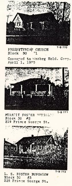 Figure 4. Todd & Brown photos of Presbyterian Church (T-B 770), Merritt Foster Bungalow (T-B 771), and L.S. Foster Bungalow (T-B 772).
Unlike many other excavated areas, Ragland did not write an archaeological report for these properties. A map, however, was prepared by draftsman James M. Knight on August 27, 1951. This map depicted at least nine brick foundations, described on the appended feature forms. The Deane House foundation (labelled A-1) was located at the corner of Prince George and Palace Streets (Figures 6 and 7). The Deane Kitchen foundation, labelled A-3, was located about 30 feet west of this structure (Figure 8), and a well, labelled C, was found some 56 feet to the northwest. Two post-colonial foundations, labelled A-4 and A-5, were located about 45 feet west of the Deane House, slightly south of the kitchen foundation (Figure 9). Neither of these foundations was identified, but A-4 appears to be a squarish 20 foot wide structure with a chimney or firebox on the north wall, while A-5 (which post-dates A-4) is the west wall 0+ a small outbuilding with at least one interior partition.
The foundation of the Presbyterian Church was also located in this area, some 15 feet west of the Deane House. An earlier foundation to this Church, an Palace Street some 8 feet north of the Deane House, was also located.
On the western Foster Lot, Ragland found the foundation of a shop, labelled B-1, which was at least 16 by 20 feet in size with a firebox on the interior of the west wall (Figures 10 and 11). A fallen piece of brick wall was located just west of this foundation, and a 5 by 7 foot firebox, labelled B-2, was found just west of this fallen wall.
Field notes and photographs make it appear that some B-10 inches of dirt was removed over most of the excavated area, enough to expose the first two or three courses of brick foundations. Interior fill was left within the Deane Kitchen and the Deane Shop and Forge. At least nine courses of brick were exposed on the interior of the Deane House. A screen shown in the background on photo N1216 suggests that at least some dirt was sifted.
The area where the garden actually now stands was probably excavated somewhat later, after the Foster bungalows were torn down. There is no archaeological report on this project either, and no map of this part of the property has been drawn. James Knight (pers. comm. 1985 believes that the lots were cross-trenched, but since no old structural remains were found the area was not individually mapped. The modern foundations of the Foster bungalows may have been discovered but not drawn.
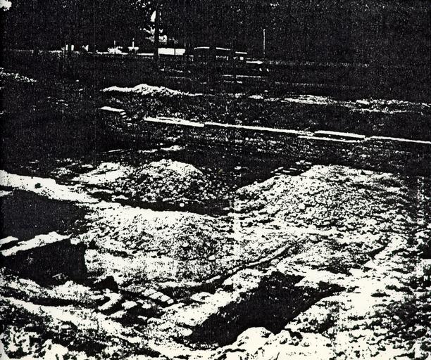 Figure 6. Elkanah Deane House foundation. Photo N944.
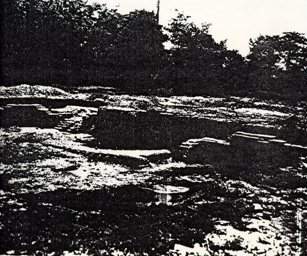 Figure 7. Elkanah Deane House foundation. Photo N345.
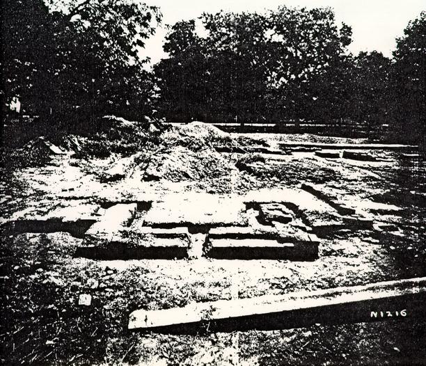 Figure 8. Elkanah Deane Kitchen foundation. Note screen on spoil heap in background. Photo N1216.
 Figure 9. Foundations of outbuildings A-4 and A-5. Second foundation of Presbyterian Church on left and lower right. Photo N1215.
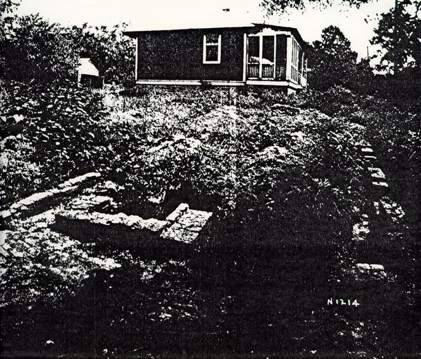 Figure 10. Elkanah Deane Forge foundation and fallen wall. Note modern L.S. Foster Bungalow in background. Photo N1214.
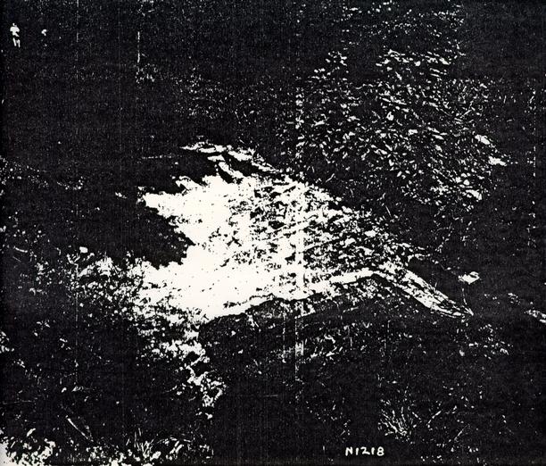 Figure 11. Elkanah Deane Forge foundation and fallen wall. Photo N1218.
Map Research
According to extant 18th century maps, at least six structures were located on or near the property. The Frenchman's Map (1782) shows the location of the Deane House and Forge, along with four other outbuildings north and west of the garden (Figures 12 and 13). No structures are shown within the boundaries of what is now the garden. The Desandrouins Map (1782) shows only a large rectangular "bland block" and three northern outbuildings which are also shown on the Frenchman's Map (Figure 14). No detail within the large rectangular area is provided. The Berthier Map similarly shows only a large bland block, but on this map even the northern outbuildings are not shown (Figure 15).
This information was the basis for the reconstruction of six buildings: the Deane House, the Deane Shop and Forge, the Deane Servant's Quarters, the Robert Carter Stable, the Robert Carter Chariot House, and the Robert Carter Meat House. None of these maps, however, habitually show smaller outbuildings such as wells and privies, so this evidence does riot rule out the possibility of smaller- structures on the part of the property on which nothing was shown, nor does it rule out the possibility of larger structures which were burnt or torn down before the maps were drawn.
Reconstruction
Seven buildings were reconstructed on the Elkanah Deane property. The Deane House (Bldg. 1-A), Deane Kitchen (Bldg. 1-B), and Deane Forge (Bldg. 1-C) were reconstructed on their original foundations, while the Deane West Privy (Bldg. 1-G), East Privy (Bldg. 1-F), Well (Bldg. 1-D), and Woodshed (Bldg. 1-H) were placed in the reconstructed garden despite the lack of any archaeological evidence for their exact locations. Three post-supported wooden shelters were also built: Deane Forge Shelter (Bldg. 1-K), Deane Bee Skep Shelter (Bldg. 1-J), and Deane Craft Shelter (Bldg. 1-L). The well actually located archaeologically, lying northwest of the Deane House, was not reconstructed.
The decision to place the garden along Prince George Street was vigorously debated in the 1930s. The plan at first was to build it north of the Deane House across from Palace Green. In a letter dated December 1, 1937, landscape architect Arthur Shurcliff describes this plan and reiterates his support for it (Letter from Shurcliff to Kenneth Chorley, December 1, 1937). Documentation was later found, however, that Deane's garden was actually "in back of the house" (Letter from Shurcliff to Chorley, March 2, 1938). "Plan 2" was then adopted,
16
 Figure 12. Blow-up of relevant portion of Frenchman's Map, compared with 18th century foundations found by Ragland. Present-day garden location is at bottom center of each map. From McWilliams 1944: Illustration #1.
17
Figure 13. Frenchman's Map.
18
Figure 14. Desandrouins Map.
19
Figure 15. Berthier Map.
20
placing the garden along Prince George Street on the axial line of the Deane House.
Figure 12. Blow-up of relevant portion of Frenchman's Map, compared with 18th century foundations found by Ragland. Present-day garden location is at bottom center of each map. From McWilliams 1944: Illustration #1.
17
Figure 13. Frenchman's Map.
18
Figure 14. Desandrouins Map.
19
Figure 15. Berthier Map.
20
placing the garden along Prince George Street on the axial line of the Deane House.
No record of the reconstruction of this garden could be found. But according to Donald Parker (pers. comm. 1985) the brick walks were probably put in before the planting was actually done. If the area was not graded first, only the top four inches of soil would be disturbed when the walkways were put in place. The planting beds would normally have been dug only a few inches deeper, to about eight to ten inches below grade. When Shurcliff described his specifications for this particular garden, however, he suggested that the garden soil be prepared "deeper...then usual" to cut down on unnecessary maintenance (Letter from Shurcliff to E.R. Holland, Jr., February 18, 1938). This suggests that any shallow archaeological features that may have been present in the planting area may now be destroyed, and that only fairly deep archaeological features could have survived.
Archaeological Potential--Reinterpretation of Shop
The development by Colonial Williamsburg of a working coachmaking exhibition at the site of the present Shop and Forge would undoubtedly entail some disturbance of archaeological remains in this area. This part of the property was cross-trenched in 1931, resulting in the discovery of the shop, exterior forge, and fallen wall. Most of the interior fill, however, was undisturbed at this time, and the foundations were exposed only to a depth of two to three brick courses.
Potentially some of the builder's trenches may remain, if the footings are deeper than the level to which they were exposed. Builder's trenches furnish key evidence to date a building's construction, and it would be important to know whether the shop was built by Deane or whether Deane simply reused an existing shop.
Further excavations in this area may also reveal fence postholes, trash pits, or activity-specific features which were missed by crosstrenching. The area in and around the shop, if remains were not destroyed during reconstruction, could be particularly interesting. The locations of the blacksmithing, woodworking, harness making, and painting and finishing may be discernible through their archaeological remains.
Complete excavation of any areas intended +or reconstruction is recommended. Outlying post-built structures may easily have been missed during cross-trenching. It is possible that archaeological evidence could be found for the locations of any shop-related outbuildings or shelters.
21A re-analysis of the artifacts recovered from the 1931 excavations may also be useful. Although these were collected only by general provenience, it may be possible to use them to gain some insight into the range of activities on the property.
References
- 1931
- Elkanah Deane or Carter House: Block 30, sites 1, 2, 3, 4, 5, 6, 7, 8. Colonial Lots # 329, 330, 331, & 332. Research report on file, Research Department, Colonial Williamsburg Foundation, Williamsburg, Va.
- 1944
- Elkanah Deane House and Shop: Block 30, Lots # 329, #330, #331, #332. Research report on file, Research Department, Colonial Williamsburg Foundation, Williamsburg, Va.
- 1806
- Policy No. 706, issued to Henry Skipwith. Policy on file, Research Department, Colonial Williamsburg Foundation, Williamsburg, Va.
- 1956
- Elkanah Deane House & Shop:Block 30, Colonial Lots 329, 330, 331, 332. Research report on file, Research Department, Colonial Williamsburg Foundation, Williamsburg, Va.
SUMMARY SHEET- KNOWN ARCHAEOLOGICAL FEATURES Block 30-B
FEATURE:
Elkanah Deane House (A-1 on map)
CATALOGUE #: 30-B
DESCRIPTION:
Bldg. 1-A. 32' x 46' brick foundation with at least two interior partitions and a 7' wide bulkhead on the south portion of the western wall. Two periods of brickwork are noted: colonial (Walls 1-7, at corners of foundation and small 3' long sections on the southern, western, and eastern sides), and later colonial (Walls 8-12, including the interior partitions and bulkhead). Bricks 8 ¾" to 9" x 4" x 2 ¾" to 3", dark and light red. Shell mortar, in English bond.
LOCATION:
Southeastern corner of Colonial Lot 332 at corner of Palace and Prince George Streets.
ASSOCIATED ARTIFACTS REPORTED:
One box reported from "Deane Lot" (30-B). Includes brass military insignia (see photo N3021).
REPORTED DISPOSITION OF ARTIFACTS:
Old Study Collection.
CURRENT COLLECTION STATUS:
Unanalyzed.
INVESTIGATOR(S):
Herbert S. Ragland (1931)
CONDITION:
Mostly excavated; some fill possibly remaining near center of building (see photo N944). Builder's trenches appear to be destroyed. Building has been reconstructed.
No report on excavation; interpreted as Deane House when reconstructed.
EXCAVATION TECHNIQUE:
Unreported, but probably cross-trenched with excavation to expose foundations when encountered. Some dirt possibly screened (see photo N1216).
REFERENCES:
Map: "Archaeological Survey of Elkannah Dean House and Outbuildings- Site of Recent First Presbyterian Church- Uncovered in Williamsburg, VA 1931", James M. Knight, draftsman, B-27-1931.
Photo: N944
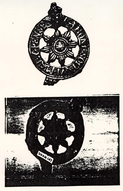 Figure 16. Brass military insignia before and after conservation. Photo N3021.
SUMMARY SHEET- KNOWN ARCHAEOLOGICAL FEATURES BLOCK 30-B
FEATURE:
Presbyterian Church, first foundation (A-2 on map)
CATALOGUE #: 30-B
DESCRIPTION:
32' x approximately 52' foundation of apparently rectangular building. No brickwork seems to have been found, as brick dimensions are not given in accompanying schedule, but this may be because the brick was obviously modern. The area under what is now Palace Street is marked with a solid line and there are C).56-0.93' differences in elevation between the "foundation" and interior. Only traces of the northwest corner and western wall seem to have been found.
LOCATION:
On north side of Deane House, about 18' north of north wall of Deane House foundation. Extends 8' into what is now Palace Street.
ASSOCIATED ARTIFACTS REPORTED:
One box reported from "Deane Lot" (30-B). Includes brass military insignia (see photo N3021).
REPORTED DISPOSITION OF ARTIFACTS:
Old Study Collection.
CURRENT COLLECTION STATUS:
Unanalyzed.
INVESTIGATOR(S):
Herbert S. Ragland (1931)
CONDITION:
Unreported, but the outlines of the foundation were apparently excavated to search for brickwork.
PAST INTERPRETATION AND SIGNIFICANCE:
No report on excavation; interpreted on map as first foundation of Presbyterian Church.
EXCAVATION TECHNIQUE:
Unreported, but probably cross-trenched with excavation to expose foundations when encountered. Some dirt probably screened (see photo N1216).
REFERENCES:
Map: "Archaeological Survey of Elkannah Dean House and Outbuildings- Site of Recent First Presbyterian Church- Uncovered in Williamsburg, VA 1931", James M. Knight, draftsman, B-27-1931.
SUMMARY SHEET- KNOWN ARCHAEOLOGICAL FEATURES BLOCK 30-B
FEATURE:
Deane Kitchen (A-7 on) map)
CATALOGUE #: 30-B
DESCRIPTION:
Bldg. 1--B. 18 x approximately 23' foundation of colonial brickwork, with fireplace foundation on west side. Only west half of foundation was uncovered. Bricks 8 ½" x 4 ¼" x ¾", light red -And salmon. Shell mortar, in English bond.
LOCATION:
West of Deane House, with west wall of kitchen foundation some 52' west of west wall of Deane House foundation (east wall
foundation of kitchen was not found).
ASSOCIATED ARTIFACTS REPORTED:
One box reported from "Deane Lot" (30-B). Includes brass military insignia (see photo N3021).
REPORTED DISPOSITION OF ARTIFACTS:
Old Study Collection.
CURRENT COLLECTION STATUS:
Unanalyzed.
INVESTIGATOR(S):
Herbert S. Ragland (1931)
CONDITION:
Partially excavated; only area around foundation excavated, with interior fill left intact. Possibly some of builder's trench left intact below the top two Courses of brick. Building reconstructed.
PAST INTERPRETATION AND SIGNIFICANCE:
No report on excavation; interpreted as kitchen when reconstructed.
EXCAVATION TECHNIQUE:
Unreported, but probably cross-trenched with excavation around foundations when exposed. No interior fill apparently excavated other than that within l' or so of foundation. Dirt apparently screened (see photo N1216).
REFERENCES:
Map: "Archaeological Survey of Elkannah Dean House and Outbuildings- Site of Recent First Presbyterian Church Uncovered in Williamsburg, VA 1931", James M. Knight, draftsman, B-27-1931.
Photo: N1216
SUMMARY SHEET- KNOWN ARCHAEOLOGICAL- FEATURES BLOCK 30-B
FEATURE:
Unidentified foundation (outbuilding?) (A-4 on map)
CATALOGUE #:30-B
DESCRIPTION:
Ten small sections of brickwork (Walls 13-16). Identified as "later" brickwork on map (presumably post-colonial). if this forms a structure, it is at least 20' x 22' in size with a possible fireplace on the north wall. Bricks 9 ½" x 4" x 2 ¾", dark brown. Shell mortar, in English bond.
LOCATION:
Southeastern corner is 40' southwest of southwestern corner of Deane House. Overlaps west wall of second foundation of Presbyterian Church. Lies along modern Prince George Street, but extends 5' into colonial street according to Waddill.
ASSOCIATED ARTIFACTS REPORTED:
One box reported from "Deane Lot" (30-B). Includes brass military insignia (see photo N3021).
REPORTED DISPOSITION OF ARTIFACTS:
Old Study Collection.
CURRENT COLLECTION STATUS:
Unanalyzed.
INVESTIGATOR(S):
Herbert S. Ragland (1931)
CONDITION:
Mostly excavated; interior fill and builder's trenches excavated until 3-4 brick courses exposed.
PAST INTERPRETATION AND SIGNIFICANCE:
No report on excavation; unidentified on map. Since it overlaps colonial street line, this seems to be rationale for interpretation as post-colonial. Elkannah Deane Woodshed (Bldg. 1-H) reconstructed just west of this foundation.
EXCAVATION TECHNIQUE:
Unreported, but probably discovered when Presbyterian Church foundation was cleared. Excavation around foundation blocks and of at least part of interior fill. Dirt possibly screened (see photo N1216).
REFERENCES:
Map: "Archaeological Survey of Elkannah Dean House and Outbuildings- Site of Recent First Presbyterian Church Uncovered in Williamsburg, VA 1931", James M. Knight, draftsman, 8-27-1931.
Photo: N1215
SUMMARY SHEET- KNOWN ARCHAEOLOGICAL FEATURES BLOCK 30-B
FEATURE:
Unidentified outbuilding foundation (A-5 on map).
CATALOGUE #: 30-B
DESCRIPTION:
Two sections of west wall of building. West wall at least 11' long, probably closer- to 20'. Identified as "later" brickwork, after that of foundation A-4. Bricks 8 ½" x 4" x 2 ½", dark red. Shell mortar, in English bond.
LOCATION:
Overlaps hypothesized east wall of foundation A-4. Southwestern corner is 45' west of southwest corner of Deane House. Extends 4' past colonial street line according to Waddill.
ASSOCIATED ARTIFACTS REPORTED:
One box reported from "Deane Lot" (30-B). Includes brass military insignia (see photo N3021).
REPORTED DISPOSITION OF ARTIFACTS:
Old Study Collection.
CURRENT COLLECTION STATUS:
Unanalyzed.
INVESTIGATOR(S):
Herbert S. Ragland (1931)
CONDITION:
Mostly excavated; interior fill and builder's trenches excavated until 3-4 brick courses were exposed.
PAST INTERPRETATION AND SIGNIFICANCE:
No report on excavation; unidentified on map. Since it overlaps colonial street line, this seems to be rationale for interpretation as post-colonial. Since there is no sign that foundation A-4 cuts it, this is probably rationale for interpreting A-4 as earlier.
EXCAVATION TECHNIQUE:
Unreported, but probably discovered when Presbyterian Church foundation was cleared. Excavation around foundation blocks and of at least part of interior fill. Dirt possibly screened (see photo N1216).
REFERENCES:
Map: "Archaeological Survey of Elkannah Dean House and Outbuildings- Site of Recent First Presbyterian Church- Uncovered in Williamsburg, VA 1931", James M. draftsman, 8-27-1931.
Photo: N1215
SUMMARY SHEET- KNOWN ARCHAEOLOGICAL- FEATURES BLOCK 30-B
FEATURE:
Presbyterian Church, second foundation (A-6 and A-7 on map)
CATALOGUE #: 30-B
DESCRIPTION:
23' x 36' L-shaped section of foundation with seven other small sections of brickwork to the northeast. Sanborn Map shows entire building as 38' x 50' block with 32' x 46' block on eastern side. Originally covered much of buried foundation of Deane House.
LOCATION:
Southeastern corner is 20' southwest of Southwestern corner of Deane House. Faces on Prince George Street with 11' extending into what is now the street.
ASSOCIATED ARTIFACTS REPORTED:
One box reported from "Deane Lot" (30-B). Includes brass military insignia (see photo N3021).
REPORTED DISPOSITION OF ARTIFACTS:
Old Study Collection.
CURRENT COLLECTION STATUS:
Unanalyzed.
INVESTIGATOR(S):
Herbert S. Ragland (1931)
CONDITION:
Mostly excavated; interior fill and builder's trenches excavated at least to the level of 3-4 brick courses.
PAST INTERPRETATION AND SIGNIFICANCE:
No report on excavation; interpreted on map as second foundation of Presbyterian Church, which was wrecked on March 10, 1931.
EXCAVATION TECHNIQUE:
Unreported, but approximate location at least probably known from wrecking of building earlier in same year. Some areas possibly found by cross-trenching. Entire area cleared to a depth of some 3-4 brick courses below top of foundation. Dirt possibly screened (see photo N1216).
REFERENCES:
Map; "Archaeological Survey of Elkannah Dean House and Outbuildings- Site of Recent First Presbyterian Church Uncovered in Williamsburg, VA 1931", James M. Knight, draftsman, 8-27-1931.
Photo: N1215
Todd & Brown photo: T-B 770
SUMMARY SHEET- KNOWN ARCHAEOLOGICAL FEATURES BLOCK 30-B
FEATURE:
Elkanah Deane Forge (B-1 on map)
CATALOGUE #: 30-B
DESCRIPTION:
Bldg. 1-C. At least 16' x 20' foundation with forge on west wall (Walls 17-19). Colonial brickwork. Reconstructed building is 50' long. Bricks 8 ½" x 4" x 2 ½", red. Shell mortar, in English bond.
LOCATION:
Southwestern corner is 280' 7 ¾" west of corner of Palace and Prince George Streets. Lies facing on Prince George Street west of Deane House. Overlaps by 4' colonial street line according to Waddill
ASSOCIATED ARTIFACTS REPORTED:
One box reported from "Deane Lot" Includes brass military insignia (see photo N3021).
REPORTED DISPOSITION OF ARTIFACTS:
Old Study Collection.
CURRENT COLLECTION STATUS:
Unanalyzed.
INVESTIGATOR(S):
Herbert S. Ragland (1?31)
CONDITION:
Partially excavated; interior fill apparently not removed, but builder's trenches destroyed to a depth of at least 6-7 courses. Building reconstructed.
PAST INTERPRETATION AND SIGNIFICANCE:
No report an excavation; interpreted as Deane Forge.
EXCAVATION TECHNIQUE:
Unreported, but probably cross-trenched with excavation around foundations when exposed. Interior fill apparently not disturbed extensively except near foundation. Dirt probably screened (see photo N1216).
REFERENCES:
Map: "Archaeological Survey of Elkannah Dean House and Outbuildings- Site of Recent First Presbyterian Church- Uncovered in Williamsburg, VA 1931", James M. Knight, draftsman, 8-27-1931.
Photos: N1218
N1214
SUMMARY SHEET- KNOWN ARCHAEOLOGICAL FEATURES BLOCK 30-B
FEATURE:
Exterior forge (B-2 on map)
CATALOGUE #: 30-B
DESCRIPTION:
5' x 7' trapezoidal foundation with 3' 2" interior width. Colonial brickwork.
LOCATION:
Southeastern corner is 7' west of west wall of Deane Forge.
ASSOCIATED ARTIFACTS REPORTED:
One box reported from "Deane Lot" Includes brass military insignia (see photo N3021).
REPORTED DISPOSITION OF ARTIFACTS:
Old Study Collection.
CURRENT COLLECTION STATUS:
Unanalyzed.
INVESTIGATOR(S):
Herbert S. Ragland (1931)
CONDITION:
Partially excavated; some fill may remain, but most of builder's trench and interior fill appears to have been destroyed.
PAST INTERPRETATION AND SIGNIFICANCE:
No report on excavation.
EXCAVATION TECHNIQUE:
Unreported, but probably cross-trenched. Excavation around foundation may have necessarily removed most or all of interior fill. Dirt possibly screened (see photo N1216).
REFERENCES:
Map: "Archaeological Survey of Elkannah Dean House and Outbuildings- Site of Recent First Presbyterian Church- Uncovered in Williamsburg, VA 1931", James M. draftsman, 8-27-1931.
SUMMARY SHEET- KNOWN ARCHAEOLOGICAL FEATURES BLOCK 30-B
FEATURE:
Fallen wall west of Deane Forge
CATALOGUE #: 30-B
DESCRIPTION:
5 ½' x 14' section of fallen brick wall.
LOCATION:
2' west of west wall of Deane Forge, east of exterior forge.
ASSOCIATED ARTIFACTS REPORTED:
One box reported from "Deane Lot" (30-B). Includes brass military insignia (see photo N3021).
REPORTED DISPOSITION OF ARTIFACTS:
Old Study Collection.
CURRENT COLLECTION STATUS:
Unanalyzed.
INVESTIGATOR(S):
Herbert S. Ragland (1931)
CONDITION:
Partially excavated cleared but apparently not removed. Some intact material may be present underneath.
PAST INTERPRETATION AND SIGNIFICANCE:
No report on excavation interpreted on map as fallen wall.
EXCAVATION TECHNIQUE:
Unreported, but probably cross-trenched. Cleared when exposed. Dirt possibly screened (see photo N1216).
REFERENCES:
Map: "Archaeological Survey of Elkannah Dean House and Outbuildings- Site of Recent First Presbyterian Church- Uncovered in Williamsburg, VA 1931", James M. Knight, draftsman, 8-27-1931.
Photos: N1214
N1218
SUMMARY SHEET- KNOWN ARCHAEOLOGICAL FEATURES BLOCK 30-B
FEATURE:
Elkanah Deane Well (C on map)
CATALOGUE #:30-B
DESCRIPTION:
2' 10" interior diameter. Bricks 8" 4 ¾" and ½" x 2 ¾" (pie-shaped).
LOCATION:
About 8' northwest of northwestern corner of first foundation of Presbyterian Church and 56' northwest of northwestern corner of Deane House.
ASSOCIATED ARTIFACTS REPORTED:
One box reported from "Deane Well"
REPORTED DISPOSITION OF ARTIFACTS:
Old Study Collection.
CURRENT COLLECTION STATUS:
Unanalyzed.
INVESTIGATOR(S):
Herbert S. Ragland (1931)
CONDITION:
Unreported, no photos. Identification of box of artifacts from well suggests that it was at least partially excavated.
PAST INTERPRETATION AND SIGNIFICANCE:
No report on excavation; interpreted on map as well.
EXCAVATION TECHNIQUE:
Unreported, but probably discovered in cross-trenching. Brickwork apparently exposed and at least part a+ well +ill excavated. Dirt possibly screened (see photo N1216).
REFERENCES:
Map: "Archaeological Survey of Elkannah Dean House and Outbuildings- Site of Recent First Presbyterian Church- Uncovered in Williamsburg, VA 1931", James M. Knight, draftsman, 8-27-1931.
SUMMARY SHEET- KNOWN ARCHAEOLOGICAL FEATURES BLOCK 30-B
FEATURE:
Elkanah Deane Well
CATALOGUE #:30-B
DESCRIPTION:
Bldg. 1-D. About 5' x 5' in size.
LOCATION:
About 70' west of Deane House.
ASSOCIATED ARTIFACTS REPORTED:
None known.
REPORTED DISPOSITION OF ARTIFACTS:
Not applicable.
CURRENT COLLECTION STATUS:
Not applicable.
INVESTIGATOR(S):
Herbert S. Ragland (1931)
CONDITION:
Reconstructed, no archaeological evidence.
PAST INTERPRETATION AND SIGNIFICANCE:
Not recorded on archaeological map. Building reconstructed as wellhead.
EXCAVATION TECHNIQUE: No archaeological traces found when area cross-trenched.
REFERENCES:
Block and Building Book, Block 30-2, Bldg. 1-D.
SUMMARY SHEET- KNOWN ARCHAEOLOGICAL FEATURES BLOCK 30-B
FEATURE:
Elkanah Deane Servant's Quarters
CATALOGUE #:30-B
DESCRIPTION:
Bldg. l-E. Approximately 25' in size with fireplace South wall.
LOCATION:
About 55' north of Deane Forge.
ASSOCIATED ARTIFACTS REPORTED:
None known.
REPORTED DISPOSITION OF ARTIFACTS:
Not applicable.
CURRENT COLLECTION STATUS:
Not applicable.
INVESTIGATOR(S):
Herbert S. Ragland (1931)
CONDITION:
Reconstructed where indicated on Frenchman's Map; no archaeological evidence.
PAST INTERPRETATION AND SIGNIFICANCE:
Not recorded on archaeological map. Building reconstructed as servant's quarters.
EXCAVATION TECHNIQUE:
No archaeological traces found when area probably cross-trenched.
REFERENCES:
Block and Building Book, Block 30-2, Bldg. 1-E.
SUMMARY SHEET- KNOWN ARCHAEOLOGICAL FEATURES BLOCK 30-B
FEATURE:
Elkanah Deane West Privy
CATALOGUE #: 30-B
DESCRIPTION:
Bldg. 1-G. About 5' x 5' in size.
LOCATION:
Southeastern corner is about 130' west of northwestern corner of Deane Kitchen.
ASSOCIATED ARTIFACTS:
None known.
REPORTED DISPOSITION OF ARTIFACTS:
Not applicable.
CURRENT COLLECTION STATUS:
Not applicable.
INVESTIGATOR(S):
Herbert S. Ragland (1931?).
CONDITION:
Reconstructed; no archaeological evidence.
PAST INTERPRETATION AND SIGNIFICANCE:
Not recorded on archaeological map. Building reconstructed as privy.
EXCAVATION TECHNIQUE:
No archaeological traces found when area probably cross-trenched.
REFERENCES:
Block and Building Book, Block 30-2, Bldg. 1-G.
SUMMARY SHEET- KNOWN ARCHAEOLOGICAL FEATURES BLOCK 30-B
FEATURE:
Elkanah Deane East Privy
CATALOGUE #:30-B
DESCRIPTION:
Bldg. 1-F. About 5' x 5' in size.
LOCATION:
Southeastern corner- is about 25' west of northwestern corner of Deane Kitchen.
ASSOCIATED ARTIFACTS REPORTED:
None known.
REPORTED POSITION OF ARTIFACTS:
Not applicable.
CURRENT COLLECTION STATUS:
Not applicable.
INVESTIGATOR(S):
Herbert S. Ragland (1931?).
CONDITION:
Reconstructed, no archaeological evidence.
PAST INTERPRETATION AND SIGNIFICANCE:
Not recorded on archaeological map. Building reconstructed as privy.
EXCAVATION TECHNIQUE:
No archaeological traces found when area probably cross-trenched.
REFERENCES: Block and Building Book, Block 30-2, Bldg. 1-F.
SUMMARY SHEET- KNOWN ARCHAEOLOGICAL FEATURES BLOCK 30-B
FEATURE:
Deane Woodshed
CATALOGUE #:30-B
DESCRIPTION:
Bldg. 1-H. About 7' x 10' in size.
LOCATION:
About 20' north of reconstructed well (Bldg. 1-D) and 60' west of Deane House.
ARTIFACTS REPORTED:
None known.
REPORTED DISPOSITION OF ARTIFACTS:
Not applicable.
CURRENT COLLECTION STATUS:
Not applicable.
INVESTIGATOR(S):
Herbert S. Ragland (1931)
CONDITION:
Reconstructed, no archaeological evidence.
PAST INTERPRETATION AND SIGNIFICANCE:
No brickwork recorded on archaeological map. Building reconstructed as woodshed.
EXCAVATION TECHNIQUE:
Probably no archaeological traces found when area cross-trenched.
REFERENCES:
Block and Building Book, Block 30-2, Bldg. 1-H.
SUMMARY SHEET- KNOWN ARCHAEOLOGICAL FEATURES BLOCK 30-B
FEATURE:
Merritt Foster- Bungalow (219 Prince George St.)
CATALOGUE--#: 30-B
DESCRIPTION:
Frame structure, 30' x 34' in size.
LOCATION:
20' east of Deane Forge-- and 160' west of Deane House, fronting on Prince George Street.
ASSOCIATED ARTIFACTS REPORTED:
None known.
DISPOSITION OF ARTIFACTS:
Not applicable.
CURRENT COLLECTION STATUS:
Not applicable.
INVESTIGATOR(S):
Herbert S. Ragland (1931?).
CONDITION:
Torn down.
PAST INTERPRETATION AND SIGNIFICANCE:
Modern house; destroyed during Restoration.
EXCAVATION TECHNIQUE:
Area probably cross-trenched.
REFERENCES:
Todd & Brown photo: T-B 771
SUMMARY SHEET- KNOWN ARCHAEOLOGICAL FEATURES BLOCK 30-B
FEATURE:
L.S. Foster Bungalow (225 Prince George St.)
CATALOGUE #: 30-B
DESCRIPTION:
Frame structure, 30' x 34' in size.
LOCATION:
80' east of Deane Forge and 100' west of Deane House, fronting on Prince George Street.
ASSOCIATED ARTIFACTS REPORTED:
None known.
REPORTED DISPOSITION OF ARTIFACTS:
Not applicable.
CURRENT COLLECTION STATUS:
Not applicable.
INVESTIGATOR(S):
Herbert S. Ragland (1931?).
CONDITION:
Torn down.
PAST INTERPRETATION AND SIGNIFICANCE:
Modern house; destroyed during Restoration.
EXCAVATION TECHNIQUE:
Area probably cross-trenched.
REFERENCES:
Todd & Brown photo: T-B 772